Whether you’re a local history buff, a geography student, or a business owner analyzing regional demographics, understanding Wisconsin’s layout is essential.
With 72 distinct counties, the “Badger State” offers a complex tapestry of political boundaries, historical shifts, and diverse landscapes ranging from the bustling streets of Milwaukee to the Northwoods’ serene lakes.
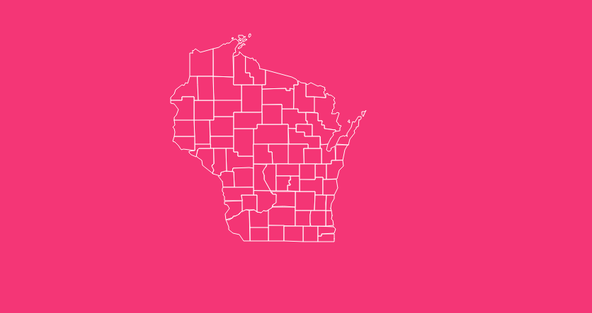
How to Use the Map Tool on This Page

Hover Highlight
Simply move your cursor over any county to instantly see its name and boundary. This feature eliminates the guesswork of trying to match small text labels to irregular shapes.
Zoom In/Out
Need to see the intricate coastline of Door County or the specific shape of Ozaukee? Use the zoom function to get a closer look at border details without losing resolution.
Dark Mode Toggle
If you are working late or prefer high-contrast visuals, switch to dark mode. This is particularly helpful for presenters who want the map to pop against a dark background.
Reset Button
If you’ve zoomed in too far or lost your place, the reset button instantly snaps the view back to the full state perspective.
Download Options
Whether you need a map for a classroom presentation or a graphic design project, look for options to download blank, printable maps in SVG (scalable vector graphics) and PNG formats.
Historical Overview of County Formation
Wisconsin’s county boundaries weren’t drawn overnight. They are the result of decades of legislative action and territorial evolution.
The process began long before statehood. Between 1818 and 1836, the Michigan Territorial Legislature established the initial counties in the region.
As the area moved toward independence, the Wisconsin Territorial Legislature took over from 1836 to 1848, carving out new jurisdictions to manage the growing settler population.
After Wisconsin officially became a state in 1848, the Wisconsin State Legislature assumed the sole authority to create, merge, or abolish counties. This power is enshrined in Article 4 of the state constitution.
The map continued to evolve well into the 20th century. For instance, several counties underwent name changes that reflect the state’s shifting political and cultural landscape:
- Bad Axe became Vernon County in 1862.
- Dallas was renamed Barron County in 1869.
- New County eventually became Langlade County in 1880.
- Gates was changed to Rusk County in 1905.
These changes highlight that the map of Wisconsin is not just a geographical document, but a historical record of the people who settled there.
Geographical Overview of Wisconsin
Wisconsin is a geographically significant state, covering approximately 65,496 square miles. While roughly 54,158 square miles of this is land, the state is defined by water.
It boasts the fourth-largest water area in the United States, a testament to its location between two Great Lakes and its thousands of inland water bodies.
Land Area Extremes
Marathon County dominates the map as the largest county by land area at 1,545 square miles. In contrast, Ozaukee County is the smallest, covering just 232 square miles.
Water Features
The state contains 15,074 documented lakes. The largest inland lake is Lake Winnebago (206 sq mi), while the deepest natural inland lake is Green Lake, plunging to 236 feet.
Elevation
The highest point in the state is Timms Hill in Price County, reaching an elevation of 1,951.5 feet.
Understanding these physical traits helps explain why population centers formed where they did and why certain counties are hubs for tourism and agriculture.
Key Features of a Wisconsin County Map
When selecting a map for research or business, ensure it includes these vital data layers:
County Seats
Identifying the administrative capital of each county (e.g., Madison in Dane County) is crucial for government and legal research.
FIPS Codes
The Federal Information Processing Standards codes are essential for data integration. Wisconsin’s state code is 55, and each county has a unique three-digit extension (e.g., Adams County is 55001).
Major Infrastructure
A good map often overlays major road networks, including interstates and U.S. highways, to show how counties are connected.
Neighboring Context
Seeing the borders of Minnesota, Michigan, Iowa, and Illinois helps place Wisconsin counties in a broader regional context.
Important Wisconsin County Insights
Beyond the lines on the map, the demographics of Wisconsin’s counties tell a story of contrast between urban density and rural expanse.
Population Centers
Milwaukee County is by far the most populous, with an estimated 924,740 residents. This urban density drives much of the state’s economic activity.
Rural Quiet
On the other end of the spectrum is Menominee County, with a population of roughly 4,286.
It is unique not just for its small population, but because its boundaries are coterminous with the Menominee Indian Reservation.
Geographical Diversity
From the driftless area in the southwest, which was untouched by glaciers, to the sandy central plains and the northern highlands,
Wisconsin’s counties encompass vastly different terrains that influence local economies, from dairy farming to timber and tourism.
The Importance of County Data
Why does county-level data matter? For businesses, it is the foundation of market research. Understanding which counties have growing populations versus those that are shrinking helps in site selection and targeted marketing.
For educators and policymakers, county data reveals trends in education, public health, and infrastructure needs.
By utilizing accurate maps and FIPS codes, analysts can merge geographical data with census statistics to visualize anything from median household income to voting patterns across the state.
List of Wisconsin Counties
The following table provides a comprehensive list of all 72 counties in Wisconsin, including their FIPS codes, county seats, and the year they were established.
| County Name | FIPS Code | County Seat | Established |
| Adams | 55001 | Friendship | 1848 |
| Ashland | 55003 | Ashland | 1860 |
| Barron | 55005 | Barron | 1859 |
| Bayfield | 55007 | Washburn | 1845 |
| Brown | 55009 | Green Bay | 1818 |
| Buffalo | 55011 | Alma | 1853 |
| Burnett | 55013 | Siren | 1856 |
| Calumet | 55015 | Chilton | 1836 |
| Chippewa | 55017 | Chippewa Falls | 1845 |
| Clark | 55019 | Neillsville | 1853 |
| Columbia | 55021 | Portage | 1846 |
| Crawford | 55023 | Prairie du Chien | 1818 |
| Dane | 55025 | Madison | 1836 |
| Dodge | 55027 | Juneau | 1836 |
| Door | 55029 | Sturgeon Bay | 1851 |
| Douglas | 55031 | Superior | 1854 |
| Dunn | 55033 | Menomonie | 1854 |
| Eau Claire | 55035 | Eau Claire | 1856 |
| Florence | 55037 | Florence | 1882 |
| Fond du Lac | 55039 | Fond du Lac | 1836 |
| Forest | 55041 | Crandon | 1885 |
| Grant | 55043 | Lancaster | 1836 |
| Green | 55045 | Monroe | 1836 |
| Green Lake | 55047 | Green Lake | 1858 |
| Iowa | 55049 | Dodgeville | 1829 |
| Iron | 55051 | Hurley | 1893 |
| Jackson | 55053 | Black River Falls | 1853 |
| Jefferson | 55055 | Jefferson | 1836 |
| Juneau | 55057 | Mauston | 1856 |
| Kenosha | 55059 | Kenosha | 1850 |
| Kewaunee | 55061 | Kewaunee | 1852 |
| La Crosse | 55063 | La Crosse | 1851 |
| Lafayette | 55065 | Darlington | 1846 |
| Langlade | 55067 | Antigo | 1879 |
| Lincoln | 55069 | Merrill | 1874 |
| Manitowoc | 55071 | Manitowoc | 1836 |
| Marathon | 55073 | Wausau | 1850 |
| Marinette | 55075 | Marinette | 1879 |
| Marquette | 55077 | Montello | 1836 |
| Menominee | 55078 | Keshena | 1961 |
| Milwaukee | 55079 | Milwaukee | 1835 |
| Monroe | 55081 | Sparta | 1854 |
| Oconto | 55083 | Oconto | 1851 |
| Oneida | 55085 | Rhinelander | 1885 |
| Outagamie | 55087 | Appleton | 1851 |
| Ozaukee | 55089 | Port Washington | 1853 |
| Pepin | 55091 | Durand | 1858 |
| Pierce | 55093 | Ellsworth | 1853 |
| Polk | 55095 | Balsam Lake | 1853 |
| Portage | 55097 | Stevens Point | 1836 |
| Price | 55099 | Phillips | 1879 |
| Racine | 55101 | Racine | 1836 |
| Richland | 55103 | Richland Center | 1842 |
| Rock | 55105 | Janesville | 1836 |
| Rusk | 55107 | Ladysmith | 1901 |
| Sauk | 55111 | Baraboo | 1840 |
| Sawyer | 55113 | Hayward | 1883 |
| Shawano | 55115 | Shawano | 1853 |
| Sheboygan | 55117 | Sheboygan | 1836 |
| St. Croix | 55109 | Hudson | 1840 |
| Taylor | 55119 | Medford | 1875 |
| Trempealeau | 55121 | Whitehall | 1854 |
| Vernon | 55123 | Viroqua | 1851 |
| Vilas | 55125 | Eagle River | 1893 |
| Walworth | 55127 | Elkhorn | 1836 |
| Washburn | 55129 | Shell Lake | 1883 |
| Washington | 55131 | West Bend | 1836 |
| Waukesha | 55133 | Waukesha | 1846 |
| Waupaca | 55135 | Waupaca | 1851 |
| Waushara | 55137 | Wautoma | 1851 |
| Winnebago | 55139 | Oshkosh | 1840 |
| Wood | 55141 | Wisconsin Rapids | 1856 |
Frequently Asked Questions
How many counties are in Wisconsin?
There are 72 counties in Wisconsin. This number has remained stable since Menominee County was created in 1961.
What is the largest county in Wisconsin?
Marathon County is the largest by land area, covering approximately 1,545 square miles.
What is the smallest county in Wisconsin?
Ozaukee County is the smallest by land area, covering only 232 square miles.
Which Wisconsin county has the highest population?
Milwaukee County is the most populous, home to nearly 925,000 residents.
What is the state FIPS code for Wisconsin?
The state FIPS code for Wisconsin is 55. This prefix is used for all county codes (e.g., 55001).
Were there any proposed counties that didn’t happen?
Yes, history records two notable attempts: Tuskola (proposed in 1850) and Century (proposed in 1997). Neither was successfully established.
What is the newest county in Wisconsin?
Menominee County is the newest, established in 1961 from parts of Shawano and Oconto counties to align with the Menominee Indian Reservation.
Why was “Bad Axe” county renamed?
The name “Bad Axe” was considered unappealing to potential settlers and investors, so it was renamed Vernon County in 1862 to sound more inviting.
Which authority creates counties in Wisconsin?
Since 1848, only the Wisconsin State Legislature has had the authority to create, abolish, or merge counties.
Where can I find official road maps for each county?
The Wisconsin Department of Transportation (WisDOT) provides detailed PDF road maps for all 72 counties, which include town roads, recreational areas, and township boundaries.
Download Your Free Map
Ready to use this data for your own projects? Download a high-resolution, printable Wisconsin county map or an interactive SVG file to get started today.
[Download Free Map].