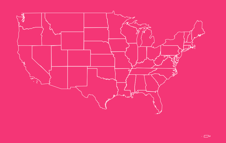
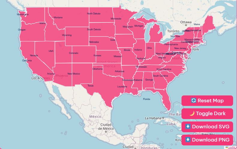
Tip: Click any state to open its page. Use zoom in/out or reset to explore easily. You can also download the political map as PNG or blank printable SVG for your own use.
Browse All 50 U.S. States
| Alabama | Alaska |
| Arizona | Arkansas |
| California | Colorado |
| Connecticut | Delaware |
| Florida | Georgia |
| Hawaii | Idaho |
| Illinois | Indiana |
| Iowa | Kansas |
| Kentucky | Louisiana |
| Maine | Maryland |
| Massachusetts | Michigan |
| Minnesota | Mississippi |
| Missouri | Montana |
| Nebraska | Nevada |
| New Hampshire | New Jersey |
| New Mexico | New York |
| North Carolina | North Dakota |
| Ohio | Oklahoma |
| Oregon | Pennsylvania |
| Rhode Island | South Carolina |
| South Dakota | Tennessee |
| Texas | Utah |
| Vermont | Virginia |
| Washington | West Virginia |
| Wisconsin | Wyoming |
The United States is a vast and varied nation, stretching from the Atlantic to the Pacific Ocean.
Its geography is as diverse as its population, featuring everything from towering mountain ranges and expansive plains to arid deserts and lush subtropical coastlines.
For students, travelers, and researchers, understanding this complex landscape is essential.
A USA state map is more than just a tool for navigation; it is a key to unlocking the country’s physical, cultural, and historical identity.
Quick Facts: United States of America
To get started, here are some essential facts about the United States.
| Quick Fact | Detail |
| Capital | Washington, D.C. |
| Date of independence | July 4, 1776 |
| Total States | 50 |
| Total population | ~ 334 million (2024 estimate) |
| Total Area | 3,794,100 sq mi (9,826,675 km²) |
| Largest State | Alaska (by area) |
| Smallest State | Rhode Island (by area) |
| Most Populated state | California |
| National motto | In God We Trust |
| Official Language | None at the federal level, but English is the de facto national language. |
| Currency | United States Dollar ($) |
The Physical Geography of the USA
The United States’ physical landscape is incredibly diverse, marked by prominent mountain ranges, vast plains, and extensive river systems.
A physical map helps visualize these features in detail.
Major Landforms
The country can be broadly divided into several key physiographic regions:
Mountain Ranges
Two primary mountain systems dominate the US. The Appalachian Mountains in the east are older, more weathered, and lower in elevation.
In contrast, the Rocky Mountains in the west are younger, more rugged, and feature some of the nation’s highest peaks, like Denali in Alaska at 20,310 feet (6,190.5 m).
Plains
The vast Great Plains stretch through the country’s center, forming a massive expanse of flat and rolling terrain.
This region is a critical agricultural hub, often called America’s breadbasket.
Coastal Regions
The US has extensive coastlines along the Atlantic, Pacific, and Gulf of Mexico.
The Atlantic coast features sandy beaches and estuaries, while the Pacific coast is known for its rocky shores and dramatic cliffs.
Deserts
The American Southwest is home to several major deserts.
The Mojave Desert, the driest in North America, and the Sonoran Desert are characterized by their unique flora and fauna adapted to arid conditions.
The lowest point in the country, Badwater Basin in Death Valley, is located in the Mojave Desert at -279 feet (-85 m).
Rivers and Lakes
Waterways have been crucial to the development and settlement of the United States.
River Systems
The Mississippi-Missouri River system is the largest in North America, draining a massive portion of the country’s interior.
The Colorado River, famous for carving the Grand Canyon, is a vital water source for the arid Southwest.
Lakes
The Great Lakes Superior, Michigan, Huron, Erie, and Ontario form the largest group of freshwater lakes on Earth by total area.
They are a dominant feature of the northern US. In the West, the Great Salt Lake in Utah is the largest saltwater lake in the Western Hemisphere.
Climate Regions Across the US
The sheer size of the United States results in a wide variety of climates, which can be visualized on a climate map.
According to NOAA’s climate data, these zones significantly influence local lifestyles, agriculture, and natural ecosystems.
Arctic and Subarctic (Alaska)
Alaska experiences polar climates, with long, extremely cold winters and short, cool summers.
Temperate and Continental (Northeast and Midwest)
These regions have four distinct seasons, with warm summers and cold, snowy winters.
Humid Subtropical (Southeast)
Characterized by hot, humid summers and mild winters, this climate supports a long growing season.
Tropical (South Florida and Hawaii)
These areas enjoy warm temperatures year-round, with distinct wet and dry seasons.
Desert and Arid (Southwest)
The Southwest receives very little rainfall and experiences extreme temperatures, with scorching hot summers.
Mediterranean (Coastal California)
This climate features warm, dry summers and mild, wet winters, ideal for growing fruits and vegetables.
The climate’s impact is profound. For example, the fertile plains of the Midwest are perfect for corn and soybean farming, while the warm climate of Florida and California allows for citrus fruit production.
Exploring the States and Regions
The USA states map is often divided into five main regions, each with its own distinct culture, economy, and geography.
Northeast
States
Connecticut, Maine, Massachusetts, New Hampshire, Rhode Island, Vermont, New Jersey, New York, Pennsylvania.
Features
This region is known for its historic cities like New York City and Boston, picturesque coastlines, and the beautiful autumn foliage of the Appalachian Mountains.
It’s a hub of finance, education, and culture.
Southeast
States
Alabama, Arkansas, Florida, Georgia, Kentucky, Louisiana, Mississippi, North Carolina, South Carolina, Tennessee, Virginia, West Virginia.
Features
Home to a humid subtropical climate, the Southeast boasts lush landscapes, long coastlines on the Atlantic and Gulf of Mexico, and a rich cultural heritage.
Cities like Atlanta and Miami are major economic centers.
Midwest
States
Illinois, Indiana, Iowa, Kansas, Michigan, Minnesota, Missouri, Nebraska, North Dakota, Ohio, South Dakota, Wisconsin.
Features
Often called “America’s Heartland,” the Midwest is characterized by its vast plains and the Great Lakes. Agriculture is a dominant industry, and cities like Chicago serve as vital transportation and commercial hubs.
Southwest
States
Arizona, New Mexico, Oklahoma, Texas.
Features
This region is defined by its dramatic desert landscapes, including the Grand Canyon. It has a unique cultural blend with strong Native American and Hispanic influences.
The economy is driven by resources like oil and natural gas.
West
States
Alaska, California, Colorado, Hawaii, Idaho, Montana, Nevada, Oregon, Utah, Washington, Wyoming.
Features
The West is a region of extremes, containing the highest and lowest points in the country. It includes the Rocky Mountains, the Pacific coastline, and the deserts of the Great Basin.
California is the most populous state, a global center for technology and entertainment.
Natural Resources and Land Use
The United States is rich in natural resources, which have been fundamental to its economic growth.
A land use map shows how different areas are utilized, from farming to urban development. According to the USGS, key resources include:
Fossil Fuels
The country has significant reserves of coal, oil, and natural gas, particularly in regions like the Southwest and parts of the Midwest.
Minerals
A wide range of minerals are mined, including copper, gold, iron, lead, and silver.
Timber
Vast forests, especially in the Pacific Northwest and the Southeast, provide a substantial supply of timber.
Understanding Through Different Maps
To get a full picture of the United States, it’s helpful to look at several types of maps. Each one offers a unique perspective on the country’s geography and society.
Political Map
A USA political map shows the 50 states, their borders, capitals, and major cities. It’s the most common type of map and is essential for understanding the country’s administrative divisions.
Physical Map
This map highlights natural features like mountains, rivers, and lakes. It provides a clear picture of the country’s topography and is invaluable for understanding its physical geography.
Climate Map
Using color codes, this map illustrates the different climate zones across the US. It’s useful for travelers and anyone interested in how climate affects different regions.
Historical Map
Historical maps show how the country’s boundaries have changed over time, from the original 13 colonies to westward expansion. They provide powerful insights into key historical events.
Population Density Map
This map uses color gradients to show where people live. It highlights the concentration of populations in urban centers and the vast, sparsely populated areas of the country.
Land Use Map
This map categorizes how land is utilized, whether for agriculture, cities, forests, or conservation. It reflects the economic activities and environmental priorities of different regions.
Specialized Maps
For those with specific interests, geological, soil, and vegetation maps offer even more detailed information about the natural world.
Unlock the Story of the USA with Maps
Ready to start your own exploration? Dive into the world of cartography and discover the countless stories waiting to be told by the maps of the United States.
Frequently Asked Questions
Who created the first official map of the United States?
The first official map of the United States was published in 1784 by Abel Buell, a cartographer from Connecticut. It was the first map made, printed, and copyrighted in America by an American citizen.
How are U.S. state borders determined?
State borders were shaped by historical treaties, rivers, mountain ranges, and colonial boundaries. Many were drawn during westward expansion and political negotiations between states and territories.
What’s the difference between a state and a U.S. territory?
A state has full representation in Congress and sovereignty within the federal system.
A territory, such as Puerto Rico or Guam, is governed by the U.S. but doesn’t have full voting rights in Congress.
What are the time zones across the United States?
The U.S. spans six main time zones:
- Eastern
- Central
- Mountain
- Pacific
- Alaska
- Hawaii-Aleutian
Some U.S. territories follow additional local time zones.
What are the most visited states in the USA?
According to tourism data, the most visited states include California, Florida, New York, Texas, and Nevada, thanks to attractions like national parks, beaches, and major cities.
Which U.S. states share borders with Canada?
Thirteen U.S. states share borders with Canada, including Alaska, Washington, Montana, North Dakota, Minnesota, Michigan, New York, Vermont, New Hampshire, and Maine.
Which U.S. states share borders with Mexico?
Four states border Mexico: California, Arizona, New Mexico, and Texas.
How many U.S. states have coastlines?
Out of 50 states, 30 have coastlines, either along the Atlantic Ocean, Pacific Ocean, or Gulf of Mexico. The longest coastline belongs to Alaska, followed by Florida.
What is the most geographically diverse U.S. state?
California is considered the most geographically diverse state, featuring beaches, deserts, forests, and mountains all within a single state.
What is the only U.S. state made up entirely of islands?
Hawaii is the only U.S. state composed entirely of islands, located in the central Pacific Ocean.
Which U.S. states are landlocked?
There are 27 landlocked states, meaning they don’t touch an ocean or gulf. Examples include Colorado, Kentucky, Nebraska, and Tennessee.
What projection is commonly used in USA maps?
Most U.S. maps use the Albers Equal Area Conic projection, which minimizes distortion for the country’s size and shape, especially for thematic and educational maps.
How often are official U.S. maps updated?
Official maps are updated after each U.S. Census (every 10 years) and periodically by agencies like the U.S. Geological Survey (USGS) to reflect boundary or geographic data changes.
What is the geographic center of the United States?
The geographic center of the contiguous United States is near Lebanon, Kansas. When including Alaska and Hawaii, it shifts to Belle Fourche, South Dakota.
What is the highest and lowest point in the United States?
- Highest Point: Denali, Alaska (20,310 ft / 6,190.5 m)
- Lowest Point: Badwater Basin, Death Valley, California (-282 ft / -86 m)
What are the U.S. states with the most lakes?
Alaska, Minnesota, and Wisconsin have the most lakes. Alaska alone has over 3 million lakes larger than 5 acres.