Everything is bigger in Texas, and its administrative divisions are no exception.
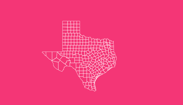
With a staggering 254 counties more than any other state in the U.S., the Texas county map is a complex mosaic of history, geography, and culture.
Whether you are a researcher, a student, a traveler planning a road trip, or a proud Texan looking to understand your state better, navigating this map unlocks a deeper understanding of the Lone Star State.
How to Use the Tool on This Page
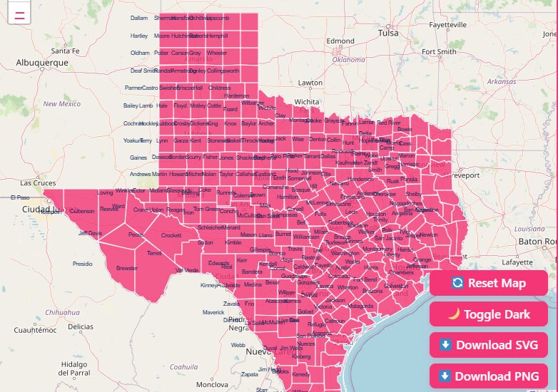
Hover Highlight
Simply move your mouse over any county on the map to instantly highlight its boundaries and see its name pop up.
Zoom In/Out
Use the + and – buttons or scroll with your mouse wheel to get a closer look at specific regions or zoom out for a state-wide view.
Dark Mode Toggle
Switch between light and dark modes to reduce eye strain during late-night research sessions.
Reset Button
If you’ve zoomed in too far or lost your place, hit the reset button to return to the default view.
Download Options
Need a map for a presentation or classroom activity? You can download high-quality versions of the map directly.
- Download Blank Printable Map (SVG & PNG): Perfect for quizzes or labeling exercises.
- Download Detailed Map: Get a version with all county names pre-labeled.
Historical Overview of County Formation
The sheer number of counties in Texas is a direct result of its massive size and its unique history as a republic before becoming a state.
The origin and evolution of these divisions tell a story of rapid expansion and the need for accessible local government.
Origin and Evolution
When Texas was a part of Mexico, it was divided into municipalities. After gaining independence in 1836, the Republic of Texas converted these municipalities into the first 23 counties.
As settlers moved westward and the population boomed, these original counties were subdivided, and new ones were carved out of the open territory.
Factors Influencing Establishment
The primary driver for creating so many small counties was accessibility.
In the 19th century, the goal was to ensure that any resident could travel to the county seat (the administrative capital of the county) and return home within a single day by horseback or wagon.
This “one-day ride” logic is why Texas has many small, square-shaped counties, particularly in the northern and central regions.
Other factors included:
- Political Representation: More counties meant more local officials and representation in the state legislature.
- Geographical Barriers: Rivers and terrain often dictated natural boundaries.
- Land Speculation: Creating a new county often increased land values in the chosen county seat.
The last county to be created was Loving County in 1931, solidifying the current count at 254.
Geographical Overview of Texas
Texas is geographically diverse, and its county lines often reflect the dramatic shifts in terrain. Understanding the state’s regions helps contextualize the county map.
Gulf Coast
Counties like Galveston, Nueces, and Jefferson line the Gulf of Mexico.
These areas are characterized by humidity, coastal plains, and an economy driven by shipping, oil, and tourism. The county boundaries here often follow the jagged coastline and bayous.
The Panhandle
Up north, the Panhandle consists of high plains and flat horizons. Counties here, such as Potter and Randall, are often perfectly square, reflecting the grid-like surveying methods used in the late 1800s.
This region is a powerhouse for agriculture and wind energy.
Hill Country
Central Texas, known as the Hill Country, features rolling terrain and limestone bedrock.
Counties like Gillespie, Blanco, and Hays are known for their scenic beauty, wineries, and rapid urbanization as Austin and San Antonio expand.
West Texas
Moving west into the Trans-Pecos region, counties become massive. Brewster County alone is over 6,000 square miles larger than the entire state of Connecticut.
The low population density here means there is less need for smaller administrative districts.
Exploring Notable Texas Counties
While every county has a story, a few stand out due to their economic power, historical significance, or unique attributes.
Harris County
Home to Houston, Harris County is the most populous county in Texas and the third most populous in the United States. It is an economic engine, driving industries from aerospace to energy.
- County Seat: Houston
- Key Feature: The Port of Houston and the NASA Johnson Space Center.
Travis County
Located in Central Texas, Travis County hosts the state capital, Austin. It is the political hub of the state and a center for technology and higher education, housing the University of Texas.
- County Seat: Austin
- Key Feature: The Texas State Capitol and the Colorado River.
Dallas County
A major commercial and cultural hub, Dallas County is densely populated and serves as a critical transportation node for the entire country.
- County Seat: Dallas
- Key Feature: The Arts District and major corporate headquarters.
Loving County
On the other end of the spectrum is Loving County. Located in West Texas, it is consistently the least populous county in the entire continental United States, often with fewer than 100 residents.
- County Seat: Mentone
- Key Feature: Its extremely low population density and oil production.
Important Texas County Insights
Analyzing the Texas county map reveals fascinating data points about the state’s demographics and geography.
The Importance of County Data
County-level data is vital for policymakers and businesses. It helps in:
- Resource Allocation: Determining where to build schools, hospitals, and roads.
- Emergency Management: Coordinating disaster response during hurricanes or wildfires.
- Economic Development: Identifying growth corridors and labor markets.
Largest vs. Smallest
- Largest by Area: Brewster County (6,192 sq miles).
- Smallest by Area: Rockwall County (149 sq miles).
- Largest by Population: Harris County (over 4.7 million).
- Smallest by Population: Loving County (approx. 60-100 residents depending on the year).
List of Texas Counties
For quick reference, here is a list of Texas counties, including their FIPS code, county seat, and the year they were established.
| County Name | FIPS Code | County Seat | Established Year |
| Anderson | 48001 | Palestine | 1846 |
| Andrews | 48003 | Andrews | 1876 |
| Angelina | 48005 | Lufkin | 1846 |
| Aransas | 48007 | Rockport | 1871 |
| Archer | 48009 | Archer City | 1858 |
| Armstrong | 48011 | Claude | 1876 |
| Atascosa | 48013 | Jourdanton | 1856 |
| Austin | 48015 | Bellville | 1836 |
| Bailey | 48017 | Muleshoe | 1876 |
| Bandera | 48019 | Bandera | 1856 |
| Bastrop | 48021 | Bastrop | 1836 |
| Baylor | 48023 | Seymour | 1858 |
| Bee | 48025 | Beeville | 1857 |
| Bell | 48027 | Belton | 1850 |
| Bexar | 48029 | San Antonio | 1836 |
| Blanco | 48031 | Johnson City | 1858 |
| Borden | 48033 | Gail | 1876 |
| Bosque | 48035 | Meridian | 1854 |
| Bowie | 48037 | Boston | 1840 |
| Brazoria | 48039 | Angleton | 1836 |
| Brazos | 48041 | Bryan | 1841 |
| Brewster | 48043 | Alpine | 1887 |
| Briscoe | 48045 | Silverton | 1876 |
| Brooks | 48047 | Falfurrias | 1911 |
| Brown | 48049 | Brownwood | 1856 |
| Burleson | 48051 | Caldwell | 1846 |
| Burnet | 48053 | Burnet | 1852 |
| Caldwell | 48055 | Lockhart | 1848 |
| Calhoun | 48057 | Port Lavaca | 1846 |
| Callahan | 48059 | Baird | 1858 |
| Cameron | 48061 | Brownsville | 1848 |
| Camp | 48063 | Pittsburg | 1874 |
| Carson | 48065 | Panhandle | 1876 |
| Cass | 48067 | Linden | 1846 |
| Castro | 48069 | Dimmitt | 1876 |
| Chambers | 48071 | Anahuac | 1858 |
| Cherokee | 48073 | Rusk | 1846 |
| Childress | 48075 | Childress | 1876 |
| Clay | 48077 | Henrietta | 1857 |
| Cochran | 48079 | Morton | 1876 |
| Coke | 48081 | Robert Lee | 1889 |
| Coleman | 48083 | Coleman | 1858 |
| Collin | 48085 | McKinney | 1846 |
| Collingsworth | 48087 | Wellington | 1876 |
| Colorado | 48089 | Columbus | 1836 |
| Comal | 48091 | New Braunfels | 1846 |
| Comanche | 48093 | Comanche | 1856 |
| Concho | 48095 | Paint Rock | 1858 |
| Cooke | 48097 | Gainesville | 1848 |
| Coryell | 48099 | Gatesville | 1854 |
| Cottle | 48101 | Paducah | 1876 |
| Crane | 48103 | Crane | 1887 |
| Crockett | 48105 | Ozona | 1875 |
| Crosby | 48107 | Crosbyton | 1876 |
| Culberson | 48109 | Van Horn | 1911 |
| Dallam | 48111 | Dalhart | 1876 |
| Dallas | 48113 | Dallas | 1846 |
| Dawson | 48115 | Lamesa | 1876 |
| Deaf Smith | 48117 | Hereford | 1876 |
| Delta | 48119 | Cooper | 1870 |
| Denton | 48121 | Denton | 1846 |
| DeWitt | 48123 | Cuero | 1846 |
| Dickens | 48125 | Dickens | 1876 |
| Dimmit | 48127 | Carrizo Springs | 1858 |
| Donley | 48129 | Clarendon | 1876 |
| Duval | 48131 | San Diego | 1858 |
| Eastland | 48133 | Eastland | 1858 |
| Ector | 48135 | Odessa | 1887 |
| Edwards | 48137 | Rocksprings | 1858 |
| Ellis | 48139 | Waxahachie | 1849 |
| El Paso | 48141 | El Paso | 1850 |
| Erath | 48143 | Stephenville | 1856 |
| Falls | 48145 | Marlin | 1850 |
| Fannin | 48147 | Bonham | 1837 |
| Fayette | 48149 | La Grange | 1837 |
| Fisher | 48151 | Roby | 1876 |
| Floyd | 48153 | Floydada | 1876 |
| Foard | 48155 | Crowell | 1891 |
| Fort Bend | 48157 | Richmond | 1837 |
| Franklin | 48159 | Mount Vernon | 1875 |
| Freestone | 48161 | Fairfield | 1850 |
| Frio | 48163 | Pearsall | 1858 |
| Gaines | 48165 | Seminole | 1876 |
| Galveston | 48167 | Galveston | 1838 |
| Garza | 48169 | Post | 1876 |
| Gillespie | 48171 | Fredericksburg | 1848 |
| Glasscock | 48173 | Garden City | 1887 |
| Goliad | 48175 | Goliad | 1836 |
| Gonzales | 48177 | Gonzales | 1836 |
| Gray | 48179 | Pampa | 1876 |
| Grayson | 48181 | Sherman | 1846 |
| Gregg | 48183 | Longview | 1873 |
| Grimes | 48185 | Anderson | 1846 |
| Guadalupe | 48187 | Seguin | 1846 |
| Hale | 48189 | Plainview | 1876 |
| Hall | 48191 | Memphis | 1876 |
| Hamilton | 48193 | Hamilton | 1858 |
| Hansford | 48195 | Spearman | 1876 |
| Hardeman | 48197 | Quanah | 1858 |
| Hardin | 48199 | Kountze | 1858 |
| Harris | 48201 | Houston | 1836 |
| Harrison | 48203 | Marshall | 1839 |
| Hartley | 48205 | Channing | 1876 |
| Haskell | 48207 | Haskell | 1858 |
| Hays | 48209 | San Marcos | 1848 |
| Hemphill | 48211 | Canadian | 1876 |
| Henderson | 48213 | Athens | 1846 |
| Hidalgo | 48215 | Edinburg | 1852 |
| Hill | 48217 | Hillsboro | 1853 |
| Hockley | 48219 | Levelland | 1876 |
| Hood | 48221 | Granbury | 1866 |
| Hopkins | 48223 | Sulphur Springs | 1846 |
| Houston | 48225 | Crockett | 1837 |
| Howard | 48227 | Big Spring | 1876 |
| Hudspeth | 48229 | Sierra Blanca | 1917 |
| Hunt | 48231 | Greenville | 1846 |
| Hutchinson | 48233 | Stinnett | 1876 |
| Irion | 48235 | Mertzon | 1889 |
| Jack | 48237 | Jacksboro | 1856 |
| Jackson | 48239 | Edna | 1836 |
| Jasper | 48241 | Jasper | 1836 |
| Jeff Davis | 48243 | Fort Davis | 1887 |
| Jefferson | 48245 | Beaumont | 1836 |
| Jim Hogg | 48247 | Hebbronville | 1913 |
| Jim Wells | 48249 | Alice | 1911 |
| Johnson | 48251 | Cleburne | 1854 |
| Jones | 48253 | Anson | 1858 |
| Karnes | 48255 | Karnes City | 1854 |
| Kaufman | 48257 | Kaufman | 1848 |
| Kendall | 48259 | Boerne | 1862 |
| Kenedy | 48261 | Sarita | 1921 |
| Kent | 48263 | Jayton | 1876 |
| Kerr | 48265 | Kerrville | 1856 |
| Kimble | 48267 | Junction | 1858 |
| King | 48269 | Guthrie | 1876 |
| Kinney | 48271 | Brackettville | 1850 |
| Kleberg | 48273 | Kingsville | 1913 |
| Knox | 48275 | Benjamin | 1858 |
| Lamar | 48277 | Paris | 1840 |
| Lamb | 48279 | Littlefield | 1876 |
| Lampasas | 48281 | Lampasas | 1856 |
| La Salle | 48283 | Cotulla | 1858 |
| Lavaca | 48285 | Hallettsville | 1846 |
| Lee | 48287 | Giddings | 1874 |
| Leon | 48289 | Centerville | 1846 |
| Liberty | 48291 | Liberty | 1836 |
| Limestone | 48293 | Groesbeck | 1846 |
| Lipscomb | 48295 | Lipscomb | 1876 |
| Live Oak | 48297 | George West | 1856 |
| Llano | 48299 | Llano | 1856 |
| Loving | 48301 | Mentone | 1887 |
| Lubbock | 48303 | Lubbock | 1876 |
| Lynn | 48305 | Tahoka | 1876 |
| McCulloch | 48307 | Brady | 1856 |
| McLennan | 48309 | Waco | 1850 |
| McMullen | 48311 | Tilden | 1858 |
| Madison | 48313 | Madisonville | 1853 |
| Marion | 48315 | Jefferson | 1860 |
| Martin | 48317 | Stanton | 1876 |
| Mason | 48319 | Mason | 1858 |
| Matagorda | 48321 | Bay City | 1836 |
| Maverick | 48323 | Eagle Pass | 1856 |
| Medina | 48325 | Hondo | 1848 |
| Menard | 48327 | Menard | 1858 |
| Midland | 48329 | Midland | 1885 |
| Milam | 48331 | Cameron | 1836 |
| Mills | 48333 | Goldthwaite | 1887 |
| Mitchell | 48335 | Colorado City | 1876 |
| Montague | 48337 | Montague | 1857 |
| Montgomery | 48339 | Conroe | 1837 |
| Moore | 48341 | Dumas | 1876 |
| Morris | 48343 | Daingerfield | 1875 |
| Motley | 48345 | Matador | 1876 |
| Nacogdoches | 48347 | Nacogdoches | 1836 |
| Navarro | 48349 | Corsicana | 1846 |
| Newton | 48351 | Newton | 1846 |
| Nolan | 48353 | Sweetwater | 1876 |
| Nueces | 48355 | Corpus Christi | 1846 |
| Ochiltree | 48357 | Perryton | 1876 |
| Oldham | 48359 | Vega | 1876 |
| Orange | 48361 | Orange | 1852 |
| Palo Pinto | 48363 | Palo Pinto | 1856 |
| Panola | 48365 | Carthage | 1846 |
| Parker | 48367 | Weatherford | 1855 |
| Parmer | 48369 | Farwell | 1876 |
| Pecos | 48371 | Fort Stockton | 1871 |
| Polk | 48373 | Livingston | 1846 |
| Potter | 48375 | Amarillo | 1876 |
| Presidio | 48377 | Marfa | 1850 |
| Rains | 48379 | Emory | 1870 |
| Randall | 48381 | Canyon | 1876 |
| Reagan | 48383 | Big Lake | 1903 |
| Real | 48385 | Leakey | 1913 |
| Red River | 48387 | Clarksville | 1836 |
| Reeves | 48389 | Pecos | 1883 |
| Refugio | 48391 | Refugio | 1836 |
| Roberts | 48393 | Miami | 1876 |
| Robertson | 48395 | Franklin | 1837 |
| Rockwall | 48397 | Rockwall | 1873 |
| Runnels | 48399 | Ballinger | 1858 |
| Rusk | 48401 | Henderson | 1843 |
| Sabine | 48403 | Hemphill | 1836 |
| San Augustine | 48405 | San Augustine | 1836 |
| San Jacinto | 48407 | Coldspring | 1870 |
| San Patricio | 48409 | Sinton | 1836 |
| San Saba | 48411 | San Saba | 1856 |
| Schleicher | 48413 | Eldorado | 1887 |
| Scurry | 48415 | Snyder | 1876 |
| Shackelford | 48417 | Albany | 1858 |
| Shelby | 48419 | Center | 1836 |
| Sherman | 48421 | Stratford | 1876 |
| Smith | 48423 | Tyler | 1846 |
| Somervell | 48425 | Glen Rose | 1875 |
| Starr | 48427 | Rio Grande City | 1848 |
| Stephens | 48429 | Breckenridge | 1858 |
| Sterling | 48431 | Sterling City | 1891 |
| Stonewall | 48433 | Aspermont | 1876 |
| Sutton | 48435 | Sonora | 1887 |
| Swisher | 48437 | Tulia | 1876 |
| Tarrant | 48439 | Fort Worth | 1849 |
| Taylor | 48441 | Abilene | 1858 |
| Terrell | 48443 | Sanderson | 1905 |
| Terry | 48445 | Brownfield | 1876 |
| Throckmorton | 48447 | Throckmorton | 1858 |
| Titus | 48449 | Mount Pleasant | 1846 |
| Tom Green | 48451 | San Angelo | 1874 |
| Travis | 48453 | Austin | 1840 |
| Trinity | 48455 | Groveton | 1850 |
| Tyler | 48457 | Woodville | 1846 |
| Upshur | 48459 | Gilmer | 1846 |
| Upton | 48461 | Rankin | 1887 |
| Uvalde | 48463 | Uvalde | 1850 |
| Val Verde | 48465 | Del Rio | 1885 |
| Van Zandt | 48467 | Canton | 1848 |
| Victoria | 48469 | Victoria | 1836 |
| Walker | 48471 | Huntsville | 1846 |
| Waller | 48473 | Hempstead | 1873 |
| Ward | 48475 | Monahans | 1887 |
| Washington | 48477 | Brenham | 1836 |
| Webb | 48479 | Laredo | 1848 |
| Wharton | 48481 | Wharton | 1846 |
| Wheeler | 48483 | Wheeler | 1876 |
| Wichita | 48485 | Wichita Falls | 1858 |
| Wilbarger | 48487 | Vernon | 1858 |
| Willacy | 48489 | Raymondville | 1911 |
| Williamson | 48491 | Georgetown | 1848 |
| Wilson | 48493 | Floresville | 1860 |
| Winkler | 48495 | Kermit | 1887 |
| Wise | 48497 | Decatur | 1856 |
| Wood | 48499 | Quitman | 1850 |
| Yoakum | 48501 | Plains | 1876 |
| Young | 48503 | Graham | 1856 |
| Zapata | 48505 | Zapata | 1858 |
| Zavala | 48507 | Crystal City | 1858 |
Frequently Asked Questions
Why does Texas have so many counties?
The large number of counties comes from Texas’s massive land area and 19th-century laws that aimed to keep county seats within a one-day horseback ride for all residents, ensuring accessible government.
What is the largest county in Texas by area?
Brewster County is the largest, spanning 6,192 square miles. It is located in the Big Bend region of West Texas and is larger than the states of Connecticut and Rhode Island combined.
What is the smallest county in Texas?
Rockwall County is the smallest, covering only 149 square miles. Despite its size, it is one of the fastest-growing counties in the state due to its proximity to Dallas.
Which Texas county has the highest population?
Harris County, home to Houston, has the highest population, with over 4.7 million residents as of recent census estimates.
Which Texas county has the lowest population?
Loving County in West Texas is the least populous, often recording fewer than 100 permanent residents.
Are there any dry counties left in Texas?
Yes, though the number is shrinking. As of recent years, there are still a few counties where the sale of alcohol is either completely prohibited or heavily restricted, known as “dry” or “moist” counties.
How do I find property records in a specific Texas county?
Property records are typically managed by the County Clerk’s office. You can usually search their specific website or visit the county courthouse in the county seat.
Do county lines ever change?
County lines in Texas are now very stable. The last new county (Loving County) was created in 1931, and boundaries rarely shift today unless there are minor surveying corrections.
What is the difference between a county and a municipality?
A county is an administrative division of the state, enforcing state laws and managing records.
A municipality (city or town) is a local government created by the residents to provide services like police, fire, and zoning within specific city limits.
Start Exploring Texas Today
Ready to dive deeper? Download your free Texas county map now or start zooming in on the interactive tool above to uncover the details of your favorite Texas region.