From the mist-covered peaks of the Great Smoky Mountains in the east to the blues-soaked banks of the Mississippi River in the west, Tennessee is a state defined by diversity.
While many recognize the state by its three distinct “Grand Divisions” represented by the three stars on the state flag, the true fabric of Tennessee is woven together by its 95 unique counties.
Whether you are a genealogist tracing family roots, a logistics manager planning routes, or a traveler looking for the next hidden gem, understanding the layout of these counties is essential.
How to Use the Interactive Map Tool

Hover and Highlight
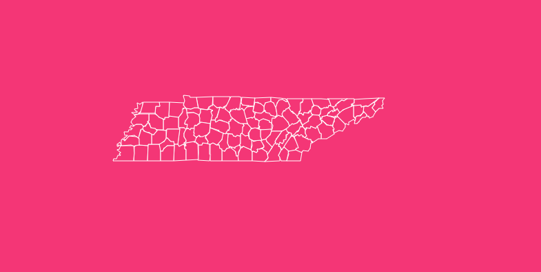
Simply move your cursor over any county on the map. The tool will instantly highlight the borders and display a tooltip containing key quick-stats, such as the county name and FIPS code.
Zoom Capabilities
Need a closer look at the smaller counties in the Middle Tennessee region? Use the + and – buttons in the corner of the map, or use your mouse scroll wheel to zoom in and out for precision viewing.
Dark Mode Toggle
If you are working late or prefer a high-contrast interface, click the “Dark Mode” toggle switch. This inverts the color scheme, making boundaries pop against a dark background for easier visibility.
Reset View
If you have zoomed in too far or lost your orientation, simply hit the “Reset” button to instantly return the map to its default statewide view.
Download Options
For users who need offline access or assets for presentations, we offer high-resolution static versions of the Tennessee county map.
Download Blank Printable SVG
Ideal for graphic designers and educators. This vector format allows you to scale the map to any size without losing quality and is perfect for editing in design software.
Download PNG
A high-quality raster image suitable for slide decks, reports, or quick printing.
Geographical Overview of Tennessee
To truly understand the county map, you must first understand the “Three Grand Divisions” of Tennessee.
These are not just cultural nicknames; they are legally recognized geographic regions that shape the state’s identity and climate.
East Tennessee
Dominated by the Appalachian Mountains and the Great Valley, this division is rugged and scenic. It includes major urban centers like Knoxville and Chattanooga.
The geography here defined the early settlement patterns, creating counties that are often shaped by ridge lines and valleys. This region contains the state’s highest point, Clingmans Dome (6,643 ft).
Middle Tennessee
This region is defined by rolling hills and fertile farmland, known as the Central Basin and Highland Rim. It is the economic and political heart of the state, home to the capital city of Nashville (Davidson County).
The Cumberland River loops through this division, influencing the boundaries of several counties.
West Tennessee
Lying between the Tennessee River and the Mississippi River, this division is geographically distinct due to its flat terrain and fertile soil, part of the Gulf Coastal Plain.
It is the agricultural hub of the state and contains Memphis (Shelby County), the state’s largest city by area.
Understanding TDOT Regions
While the Three Grand Divisions are cultural and geographical, the Tennessee Department of Transportation (TDOT) organizes the 95 counties into four operational regions to manage infrastructure and maintenance effectively.
Understanding these regions is crucial for logistics and planning.
Region 1 (Knoxville)
Covers 24 counties in the far eastern part of the state, managing the mountainous terrain and heavy interstate traffic of the I-40 and I-81 corridors.
Region 2 (Chattanooga)
It comprises 24 counties in the southeast and lower middle areas. This team manages the complex geography around the Cumberland Plateau.
Region 3 (Nashville)
Includes 26 counties in the central part of the state. This is the busiest region, handling the dense commuter traffic of the Nashville metropolitan area.
Region 4 (Jackson)
Covers 21 counties in West Tennessee. This region focuses on the flat, straight highways of the delta and the major logistics hub of Memphis.
Historical Overview of County Formation
The map of Tennessee did not always look the way it does today. The boundaries are the result of a century-long process of subdivision and settlement.
The Early Years (1777–1796)
The first counties, such as Washington County (established 1777), were vast territories that covered huge swaths of land.
When Tennessee became a state in 1796, it entered the Union with significantly fewer counties than it has today.
The Expansion Era (1806–1840)
As Indian treaties opened up new lands for settlement, migration surged. Between 1806 and 1819 alone, 22 new counties were formed.
This rapid expansion continued through 1840 as settlers petitioned the General Assembly for new counties centered closer to their homes, reducing travel time to courthouses.
The Final Borders
The process of carving out new counties largely ended in the late 19th century. The youngest county, Chester, was established in 1879.
Since then, the 95-county map has remained virtually unchanged, preserving a snapshot of 19th-century political history.
The Importance of County Data
Why does county-level data matter? In Tennessee, the county is the primary unit of local government.
Unlike some states where townships hold significant power, Tennessee counties manage courts, law enforcement, and vital records.
For business owners, understanding county lines is critical for tax jurisdictions and licensing.
For genealogists, knowing which county an ancestor lived in and when that county was established, is the key to unlocking census records and marriage licenses.
For travelers, county lines often mark changes in time zones, as the state is split between Eastern and Central time.
List of Tennessee Counties
The following table provides a complete reference for all 95 counties in Tennessee, including their Federal Information Processing Standard (FIPS) code, county seat, and the year they were established.
| County Name | FIPS Code | County Seat | Established |
| Anderson | 47001 | Clinton | 1801 |
| Bedford | 47003 | Shelbyville | 1807 |
| Benton | 47005 | Camden | 1835 |
| Bledsoe | 47007 | Pikeville | 1807 |
| Blount | 47009 | Maryville | 1795 |
| Bradley | 47011 | Cleveland | 1836 |
| Campbell | 47013 | Jacksboro | 1806 |
| Cannon | 47015 | Woodbury | 1836 |
| Carroll | 47017 | Huntingdon | 1821 |
| Carter | 47019 | Elizabethton | 1796 |
| Cheatham | 47021 | Ashland City | 1856 |
| Chester | 47023 | Henderson | 1879 |
| Claiborne | 47025 | Tazewell | 1801 |
| Clay | 47027 | Celina | 1870 |
| Cocke | 47029 | Newport | 1797 |
| Coffee | 47031 | Manchester | 1836 |
| Crockett | 47033 | Alamo | 1871 |
| Cumberland | 47035 | Crossville | 1855 |
| Davidson | 47037 | Nashville | 1783 |
| Decatur | 47039 | Decaturville | 1845 |
| DeKalb | 47041 | Smithville | 1837 |
| Dickson | 47043 | Charlotte | 1803 |
| Dyer | 47045 | Dyersburg | 1823 |
| Fayette | 47047 | Somerville | 1824 |
| Fentress | 47049 | Jamestown | 1823 |
| Franklin | 47051 | Winchester | 1807 |
| Gibson | 47053 | Trenton | 1823 |
| Giles | 47055 | Pulaski | 1809 |
| Grainger | 47057 | Rutledge | 1796 |
| Greene | 47059 | Greeneville | 1783 |
| Grundy | 47061 | Altamont | 1844 |
| Hamblen | 47063 | Morristown | 1870 |
| Hamilton | 47065 | Chattanooga | 1819 |
| Hancock | 47067 | Sneedville | 1844 |
| Hardeman | 47069 | Bolivar | 1823 |
| Hardin | 47071 | Savannah | 1819 |
| Hawkins | 47073 | Rogersville | 1786 |
| Haywood | 47075 | Brownsville | 1823 |
| Henderson | 47077 | Lexington | 1821 |
| Henry | 47079 | Paris | 1821 |
| Hickman | 47081 | Centerville | 1807 |
| Houston | 47083 | Erin | 1871 |
| Humphreys | 47085 | Waverly | 1809 |
| Jackson | 47087 | Gainesboro | 1801 |
| Jefferson | 47089 | Dandridge | 1792 |
| Johnson | 47091 | Mountain City | 1836 |
| Knox | 47093 | Knoxville | 1792 |
| Lake | 47095 | Tiptonville | 1870 |
| Lauderdale | 47097 | Ripley | 1835 |
| Lawrence | 47099 | Lawrenceburg | 1817 |
| Lewis | 47101 | Hohenwald | 1843 |
| Lincoln | 47103 | Fayetteville | 1809 |
| Loudon | 47105 | Loudon | 1870 |
| Macon | 47111 | Lafayette | 1842 |
| Madison | 47113 | Jackson | 1821 |
| Marion | 47115 | Jasper | 1817 |
| Marshall | 47117 | Lewisburg | 1836 |
| Maury | 47119 | Columbia | 1807 |
| McMinn | 47107 | Athens | 1819 |
| McNairy | 47109 | Selmer | 1823 |
| Meigs | 47121 | Decatur | 1836 |
| Monroe | 47123 | Madisonville | 1819 |
| Montgomery | 47125 | Clarksville | 1796 |
| Moore | 47127 | Lynchburg | 1871 |
| Morgan | 47129 | Wartburg | 1817 |
| Obion | 47131 | Union City | 1823 |
| Overton | 47133 | Livingston | 1806 |
| Perry | 47135 | Linden | 1819 |
| Pickett | 47137 | Byrdstown | 1879 |
| Polk | 47139 | Benton | 1839 |
| Putnam | 47141 | Cookeville | 1854 |
| Rhea | 47143 | Dayton | 1807 |
| Roane | 47145 | Kingston | 1801 |
| Robertson | 47147 | Springfield | 1796 |
| Rutherford | 47149 | Murfreesboro | 1803 |
| Scott | 47151 | Huntsville | 1849 |
| Sequatchie | 47153 | Dunlap | 1857 |
| Sevier | 47155 | Sevierville | 1794 |
| Shelby | 47157 | Memphis | 1819 |
| Smith | 47159 | Carthage | 1799 |
| Stewart | 47161 | Dover | 1803 |
| Sullivan | 47163 | Blountville | 1779 |
| Sumner | 47165 | Gallatin | 1786 |
| Tipton | 47167 | Covington | 1823 |
| Trousdale | 47169 | Hartsville | 1870 |
| Unicoi | 47171 | Erwin | 1875 |
| Union | 47173 | Maynardville | 1850 |
| Van Buren | 47175 | Spencer | 1840 |
| Warren | 47177 | McMinnville | 1807 |
| Washington | 47179 | Jonesborough | 1777 |
| Wayne | 47181 | Waynesboro | 1817 |
| Weakley | 47183 | Dresden | 1823 |
| White | 47185 | Sparta | 1806 |
| Williamson | 47187 | Franklin | 1799 |
| Wilson | 47189 | Lebanon | 1799 |
Frequently Asked Questions
What is the oldest county in Tennessee?
Washington County is the oldest, established in 1777. Interestingly, it was founded before Tennessee was even a state, initially organized under North Carolina jurisdiction.
What is the newest county in Tennessee?
Chester County is the youngest, established in 1879 from parts of Hardeman, Henderson, McNairy, and Madison counties.
Which Tennessee county has the largest population?
Shelby County (Memphis) has historically held the largest population. As of recent estimates, it boasts over 900,000 residents, though Davidson County (Nashville) is rapidly closing the gap.
Which county is the largest by land area?
Shelby County is also the largest by land area, covering approximately 755 square miles (1,955 km²).
Which county is the smallest by land area?
Trousdale County is the smallest, covering only about 114 square miles (295 km²).
What is a FIPS code?
FIPS stands for Federal Information Processing Standards. It is a unique five-digit code used to identify counties in census data. Tennessee’s state code is 47, so all county codes begin with 47 (e.g., Anderson County is 47001).
How many counties are in Tennessee?
There are 95 counties in Tennessee. This is a high number relative to the state’s size, resulting in many smaller counties compared to western US states.
Which county seat is the state capital?
Nashville is the county seat of Davidson County and serves as the capital of Tennessee.
What is the least populous county in Tennessee?
Pickett County is the least populated, with just over 5,000 residents, offering a quiet, rural atmosphere near the Kentucky border.
Are city and county governments separate in Tennessee?
Generally, yes. However, there are three consolidated city-county governments where the major city and the county administration have merged: Nashville-Davidson, Lynchburg-Moore, and Hartsville-Trousdale.
Start Exploring Tennessee Today
Whether you are downloading a blank map for a classroom project, analyzing TDOT regions for logistics, or simply looking up the establishment year of your home county, this data serves as a vital resource.
Ready to dive deeper? Use the download buttons above to get your own high-resolution map, or start clicking through the interactive tool to discover the unique story behind every border.