South Dakota is a land of stark contrasts, bridging the gap between the agricultural Midwest and the rugged American West.
For researchers, travelers, and geography enthusiasts, understanding the layout of this vast state requires more than just a glance at a highway map.
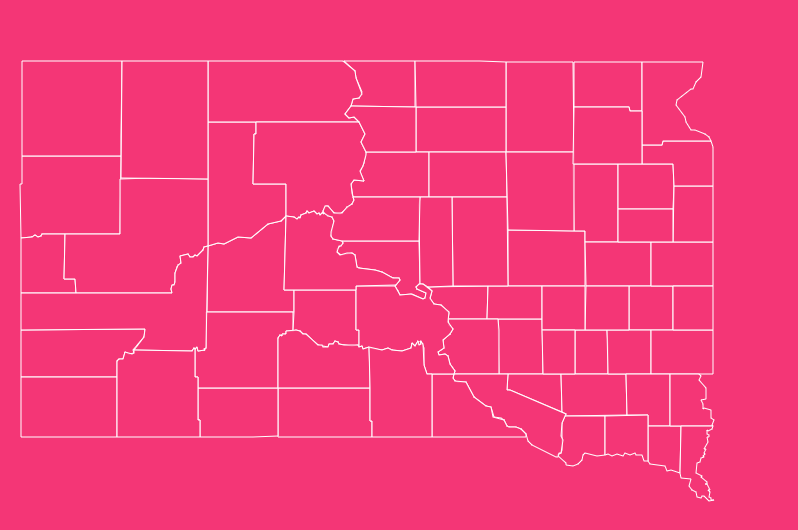
It requires a deep dive into the 66 distinct counties that make up the state’s 77,000 square miles.
How to Use the Interactive Map Tool

Hover to Highlight
Simply move your mouse cursor (or tap on mobile) over any specific county. The map will instantly highlight the borders, allowing you to clearly see the shape and neighboring boundaries.
Zoom Capabilities
Use the + and – buttons located in the corner of the map interface to zoom in for a granular view of smaller counties (like Clay County) or zoom out to see the entire state context.
Dark Mode Toggle
Working late? Switch the visual interface to “Dark Mode” using the toggle switch. This provides a high-contrast version of the map that reduces eye strain and makes the neon border highlights pop.
Reset View
If you have zoomed in too far or lost your place, hit the “Reset” button to instantly snap the map back to its original statewide perspective.
Download Options for Offline Use
We understand that sometimes you need a static reference for a presentation, report, or printed material. We offer the South Dakota county map in two high-quality, downloadable formats:
Download SVG (Scalable Vector Graphics)
Best for graphic designers and publishers. This format allows you to resize the map infinitely without losing quality. It is perfect for large posters or digital editing.
Download PNG (Portable Network Graphics)
Best for general use. This high-resolution image file has a transparent background, making it easy to drop into Word documents, PowerPoints, or student essays.
Historical Overview of South Dakota County Formation
The map of South Dakota has changed significantly since the days of the Dakota Territory.
The current arrangement of 66 counties is the result of over a century of legislative changes, mergers, and renaming efforts.
The Dakota Territory Era
Before statehood in 1889, the region was part of the vast Dakota Territory, organized in 1861. Early counties were huge, spanning vast tracts of unorganized land.
As the population grew spurred by the Homestead Act and the Black Hills Gold Rush these massive blocks were subdivided into manageable administrative units.
Notable Name Changes and Dissolved Counties
Unlike many eastern states where boundaries have remained static for centuries, South Dakota’s map has been dynamic.
Washabaugh County
Abolished in 1983 and merged with Jackson County, this was the most recent county elimination in the state.
Shannon County to Oglala Lakota County
In a historic move in 2015, Shannon County was renamed Oglala Lakota County to honor the Native American tribe that comprises the majority of its population.
Armstrong County
This county existed from 1883 until 1952, when it was annexed into Dewey County.
Geographical Overview: The “West River” vs. “East River” Divide
To truly understand South Dakota, you must understand the Missouri River.
This massive waterway slices through the center of the state, creating two distinct geographic and cultural regions known locally as “West River” and “East River.”
East River (The Glaciated Plains)
The eastern side of the state was covered by glaciers during the last Ice Age.
- Geography: The landscape is generally flatter and dotted with thousands of glacial lakes and “prairie potholes.”
- Economy: The fertile soil supports intensive agriculture, specifically corn and soybeans.
- Time Zone: This region operates almost entirely in the Central Time Zone.
West River (The Great Plains & Black Hills)
West of the Missouri, the glaciers did not reach. The terrain changes dramatically.
- Geography: This is the beginning of the true American West. The land is rolling, rugged, and arid. It includes the dramatic Badlands and the forested peaks of the Black Hills.
- Economy: Due to drier soil and rugged terrain, the economy shifts from farming to ranching and tourism.
- Time Zone: This region operates primarily in the Mountain Time Zone.
Important South Dakota County Insights
Beyond the geography, there are administrative anomalies in South Dakota that are rare elsewhere in the United States.
Counties Without County Seats
South Dakota is home to two counties that do not possess their own administrative county seat. Instead, their local government services are contracted out to neighboring counties.
- Oglala Lakota County: Administered by Fall River County (Hot Springs).
- Todd County: Administered by Tripp County (Winner).
Native American Reservations
Several counties lie entirely or partially within Native American reservations, reflecting the sovereign history of the region.
- Counties entirely within a reservation: Bennett, Corson, Dewey, Oglala Lakota, Todd, and Ziebach.
- These counties often have unique jurisdictional arrangements regarding law enforcement and land management.
The Importance of County Data (FIPS)
For data analysts, the Federal Information Processing Standards (FIPS) code is the most critical piece of information on this map. South Dakota’s state code is 46.
Every county has a unique three-digit code that follows the state code. For example, Aurora County is 003. Combined, the full FIPS code is 46003.
This standardized coding system is used by the Census Bureau, the National Weather Service, and FEMA to track:
- Population demographics.
- Emergency alerts and weather warnings.
- Federal funding allocations.
List of South Dakota Counties
Below is the complete dataset for all 66 counties, including their unique FIPS identifiers, county seats, and the year they were established.
| County Name | FIPS Code | County Seat | Established Year |
| Aurora County | 46003 | Plankinton | 1881 |
| Beadle County | 46005 | Huron | 1879 |
| Bennett County | 46007 | Martin | 1909 |
| Bon Homme County | 46009 | Tyndall | 1862 |
| Brookings County | 46011 | Brookings | 1862 |
| Brown County | 46013 | Aberdeen | 1879 |
| Brule County | 46015 | Chamberlain | 1875 |
| Buffalo County | 46017 | Gann Valley | 1873 |
| Butte County | 46019 | Belle Fourche | 1883 |
| Campbell County | 46021 | Mound City | 1873 |
| Charles Mix County | 46023 | Lake Andes | 1862 |
| Clark County | 46025 | Clark | 1873 |
| Clay County | 46027 | Vermillion | 1862 |
| Codington County | 46029 | Watertown | 1877 |
| Corson County | 46031 | McIntosh | 1909 |
| Custer County | 46033 | Custer | 1875 |
| Davison County | 46035 | Mitchell | 1873 |
| Day County | 46037 | Webster | 1879 |
| Deuel County | 46039 | Clear Lake | 1862 |
| Dewey County | 46041 | Timber Lake | 1873 |
| Douglas County | 46043 | Armour | 1873 |
| Edmunds County | 46045 | Ipswich | 1873 |
| Fall River County | 46047 | Hot Springs | 1883 |
| Faulk County | 46049 | Faulkton | 1873 |
| Grant County | 46051 | Milbank | 1873 |
| Gregory County | 46053 | Burke | 1862 |
| Haakon County | 46055 | Philip | 1914 |
| Hamlin County | 46057 | Hayti | 1873 |
| Hand County | 46059 | Miller | 1873 |
| Hanson County | 46061 | Alexandria | 1873 |
| Harding County | 46063 | Buffalo | 1909 |
| Hughes County | 46065 | Pierre | 1880 |
| Hutchinson County | 46067 | Olivet | 1862 |
| Hyde County | 46069 | Highmore | 1873 |
| Jackson County | 46071 | Kadoka | 1914 |
| Jerauld County | 46073 | Wessington Springs | 1883 |
| Jones County | 46075 | Murdo | 1916 |
| Kingsbury County | 46077 | De Smet | 1873 |
| Lake County | 46079 | Madison | 1873 |
| Lawrence County | 46081 | Deadwood | 1875 |
| Lincoln County | 46083 | Canton | 1867 |
| Lyman County | 46085 | Kennebec | 1873 |
| Marshall County | 46091 | Britton | 1885 |
| McCook County | 46087 | Salem | 1873 |
| McPherson County | 46089 | Leola | 1873 |
| Meade County | 46093 | Sturgis | 1889 |
| Mellette County | 46095 | White River | 1909 |
| Miner County | 46097 | Howard | 1873 |
| Minnehaha County | 46099 | Sioux Falls | 1862 |
| Moody County | 46101 | Flandreau | 1873 |
| Oglala Lakota County | 46102 | (Admin by Fall River) | 1875 |
| Pennington County | 46103 | Rapid City | 1875 |
| Perkins County | 46105 | Bison | 1909 |
| Potter County | 46107 | Gettysburg | 1875 |
| Roberts County | 46109 | Sisseton | 1883 |
| Sanborn County | 46111 | Woonsocket | 1883 |
| Spink County | 46115 | Redfield | 1873 |
| Stanley County | 46117 | Fort Pierre | 1873 |
| Sully County | 46119 | Onida | 1873 |
| Todd County | 46121 | (Admin by Tripp) | 1909 |
| Tripp County | 46123 | Winner | 1873 |
| Turner County | 46125 | Parker | 1871 |
| Union County | 46127 | Elk Point | 1862 |
| Walworth County | 46129 | Selby | 1873 |
| Yankton County | 46135 | Yankton | 1862 |
| Ziebach County | 46137 | Dupree | 1911 |
Frequently Asked Questions
How many counties are in South Dakota?
There are exactly 66 counties in South Dakota. This number has remained stable since the dissolution of Washabaugh County in 1983.
Which is the largest county in South Dakota by area?
Meade County is the largest by land area, covering approximately 3,471 square miles. It is located in the western part of the state and includes portions of the Black Hills.
Which is the smallest county in South Dakota?
Clay County is the smallest, covering just 412 square miles. Despite its size, it is significant as the home of the University of South Dakota.
What is the most populous county?
Minnehaha County is the most populous, home to over 200,000 residents. It contains Sioux Falls, the state’s largest city and economic hub.
Which South Dakota counties do not have a county seat?
Two counties lack a county seat: Oglala Lakota County and Todd County. They contract their administrative duties to Fall River County and Tripp County, respectively.
What is the most recently renamed county?
Oglala Lakota County was formerly known as Shannon County. The name was officially changed in May 2015 following a popular vote to honor the Oglala Lakota people.
What is the physical feature separating West River and East River counties?
The Missouri River is the dividing line. It runs north-to-south through the center of the state, creating distinct agricultural, time zone, and cultural differences between the two halves.
What is the FIPS state code for South Dakota?
The FIPS state code for South Dakota is 46. This number precedes the three-digit county code for all federal data processing (e.g., 46xxx).
Which county is Mount Rushmore located in?
Mount Rushmore National Memorial is located in Pennington County, near Keystone in the Black Hills.
Are there any counties located entirely within a reservation?
Yes, six counties are located entirely within Native American reservation boundaries: Bennett, Corson, Dewey, Oglala Lakota, Todd, and Ziebach.
The Future of South Dakota Counties
Ready to dive deeper? Start exploring the interactive map above to uncover the unique details of all 66 counties today.