Whether you’re tracing family history, planning a business expansion, or simply exploring the diverse geography of the Midwest, understanding the layout of Ohio is essential.
With 88 distinct counties, Ohio has one of the highest county counts in the nation, each with its own unique history and administrative center.
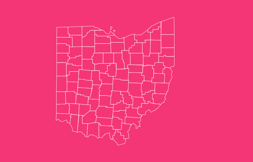
How to Use the Tool on This Page
Hover Highlight

Simply move your mouse over any county to see its name and FIPS code instantly. This eliminates the guesswork of matching shapes to names.
Zoom In/Out
Use the + and – buttons or your mouse scroll wheel to focus on specific regions, like the dense metropolitan areas of Cleveland or Cincinnati.
Dark Mode Toggle
Switch between light and dark themes to suit your viewing environment or presentation style.
Reset Button
Got lost in the details? One click returns the map to its original statewide view.
Download Options
Need a map for a report or classroom project? We offer high-resolution downloads in multiple formats:
- Blank Printable: Perfect for quizzes or coloring activities.
- SVG (Scalable Vector Graphics): Ideal for graphic designers who need to edit the map without losing quality.
- PNG: A high-quality image format ready for web use or documents.
Geographical Overview of Ohio
Ohio functions as a bridge between the Northeast and the Midwest. Its geography is surprisingly diverse, heavily influenced by glacial activity from the Ice Age.
The Glaciated Plains vs. The Allegheny Plateau
The state is generally divided into two main geographical regions:
The Glaciated Till Plains
Covering the western and northern parts of the state, this area is characterized by flat to gently rolling land.
It is the heart of Ohio’s agriculture, boasting some of the most fertile soil in the country. Counties like Darke and Wood are prime examples of this topography.
The Appalachian Plateau
Covering the eastern and southeastern sections, this region features rugged hills and valleys. It remains unglaciated, preserving its ancient geological formations.
Counties like Athens and Vinton offer stunning scenic beauty but present more challenges for infrastructure and development.
Major Waterways
Ohio’s county borders are often defined by water. The Ohio River forms the entire southern and eastern border, shaping counties from Columbiana down to Hamilton.
To the north, Lake Erie provides a coastline for counties like Cuyahoga, Erie, and Lucas, driving significant economic activity through shipping and tourism.
Historical Overview of County Formation
The map of Ohio didn’t always look like a checkerboard of 88 squares. The evolution of these boundaries is a story of political maneuvering, population growth, and settlement patterns.
The Early Years (1788–1803)
Before Ohio was even a state, the Northwest Territory began establishing counties.
Washington County
Established on July 27, 1788, this was the very first county, serving as the cradle of organized government in the territory. Marietta, its county seat, remains a historical landmark.
Hamilton County
Formed in 1790, this area became the economic hub of the southwest, centered around Cincinnati.
The Explosion of Growth (1803–1851)
When Ohio achieved statehood in 1803, the population surged.
As settlers moved northward and westward, vast counties were subdivided to ensure that citizens lived within a day’s horse ride of their county seat,
a practical necessity for legal and business matters.
The Last Revision
The final major change to Ohio’s county map occurred in 1888, exactly one century after the first county was formed.
Since then, the 88-county structure has remained stable, though minor boundary disputes have occasionally arisen.
Important Ohio County Insights
While every county matters, a few stand out for their economic, political, or geographical significance.
The Three “C” Counties
Ohio’s economy and population are anchored by three major metropolitan counties:
Franklin County (Columbus)
The seat of state government and home to The Ohio State University. It is currently the most populous county and a hub for technology and insurance.
Cuyahoga County (Cleveland)
Historically the industrial powerhouse of the state, situated on Lake Erie. It remains a center for healthcare and culture.
Hamilton County (Cincinnati)
The “Queen City” anchors the southwest, serving as a gateway to the south and a hub for commerce and logistics.
Rural Gems
Holmes County
Famous for having the world’s largest Amish settlement, offering a unique cultural enclave within the state.
Vinton County
The least populous county in Ohio. It is heavily forested and known for McArthur, its quiet county seat.
The Importance of County Data
Why does looking at an Ohio county map matter? The applications of this data extend far beyond geography class.
Government & Policy
State funding, social services, and infrastructure projects are allocated based on county lines. Understanding these boundaries is crucial for local governance.
Business Logistics
Companies use county maps to determine sales territories, delivery routes, and tax jurisdictions. Sales tax rates in Ohio vary by county, making accurate mapping a financial necessity.
Genealogy & Research
For historians and families tracing their roots, knowing which county a town belonged to in 1820 versus 1850 is vital for finding birth, marriage, and land records.
Elections
Ohio is often a political bellwether. Analysts break down voting patterns by county to predict state and national outcomes.
List of Ohio Counties
The following table provides essential data for all 88 counties, including their Federal Information Processing Standard (FIPS) codes, which are used to uniquely identify counties in census data.
| County Name | FIPS Code | County Seat | Established Year |
| Adams | 39001 | West Union | 1797 |
| Allen | 39003 | Lima | 1820 |
| Ashland | 39005 | Ashland | 1846 |
| Ashtabula | 39007 | Jefferson | 1807 |
| Athens | 39009 | Athens | 1805 |
| Auglaize | 39011 | Wapakoneta | 1848 |
| Belmont | 39013 | St. Clairsville | 1801 |
| Brown | 39015 | Georgetown | 1818 |
| Butler | 39017 | Hamilton | 1803 |
| Carroll | 39019 | Carrollton | 1833 |
| Champaign | 39021 | Urbana | 1805 |
| Clark | 39023 | Springfield | 1818 |
| Clermont | 39025 | Batavia | 1800 |
| Clinton | 39027 | Wilmington | 1810 |
| Columbiana | 39029 | Lisbon | 1803 |
| Coshocton | 39031 | Coshocton | 1810 |
| Crawford | 39033 | Bucyrus | 1820 |
| Cuyahoga | 39035 | Cleveland | 1807 |
| Darke | 39037 | Greenville | 1809 |
| Defiance | 39039 | Defiance | 1845 |
| Delaware | 39041 | Delaware | 1808 |
| Erie | 39043 | Sandusky | 1838 |
| Fairfield | 39045 | Lancaster | 1800 |
| Fayette | 39047 | Washington Court House | 1810 |
| Franklin | 39049 | Columbus | 1803 |
| Fulton | 39051 | Wauseon | 1850 |
| Gallia | 39053 | Gallipolis | 1803 |
| Geauga | 39055 | Chardon | 1806 |
| Greene | 39057 | Xenia | 1803 |
| Guernsey | 39059 | Cambridge | 1810 |
| Hamilton | 39061 | Cincinnati | 1790 |
| Hancock | 39063 | Findlay | 1820 |
| Hardin | 39065 | Kenton | 1820 |
| Harrison | 39067 | Cadiz | 1813 |
| Henry | 39069 | Napoleon | 1820 |
| Highland | 39071 | Hillsboro | 1805 |
| Hocking | 39073 | Logan | 1818 |
| Holmes | 39075 | Millersburg | 1824 |
| Huron | 39077 | Norwalk | 1809 |
| Jackson | 39079 | Jackson | 1816 |
| Jefferson | 39081 | Steubenville | 1797 |
| Knox | 39083 | Mount Vernon | 1808 |
| Lake | 39085 | Painesville | 1840 |
| Lawrence | 39087 | Ironton | 1815 |
| Licking | 39089 | Newark | 1808 |
| Logan | 39091 | Bellefontaine | 1818 |
| Lorain | 39093 | Elyria | 1822 |
| Lucas | 39095 | Toledo | 1835 |
| Madison | 39097 | London | 1810 |
| Mahoning | 39099 | Youngstown | 1846 |
| Marion | 39101 | Marion | 1820 |
| Medina | 39103 | Medina | 1812 |
| Meigs | 39105 | Pomeroy | 1819 |
| Mercer | 39107 | Celina | 1820 |
| Miami | 39109 | Troy | 1807 |
| Monroe | 39111 | Woodsfield | 1813 |
| Montgomery | 39113 | Dayton | 1803 |
| Morgan | 39115 | McConnelsville | 1817 |
| Morrow | 39117 | Mount Gilead | 1848 |
| Muskingum | 39119 | Zanesville | 1804 |
| Noble | 39121 | Caldwell | 1851 |
| Ottawa | 39123 | Port Clinton | 1840 |
| Paulding | 39125 | Paulding | 1820 |
| Perry | 39127 | New Lexington | 1817 |
| Pickaway | 39129 | Circleville | 1810 |
| Pike | 39131 | Waverly | 1815 |
| Portage | 39133 | Ravenna | 1807 |
| Preble | 39135 | Eaton | 1808 |
| Putnam | 39137 | Ottawa | 1820 |
| Richland | 39139 | Mansfield | 1808 |
| Ross | 39141 | Chillicothe | 1798 |
| Sandusky | 39143 | Fremont | 1820 |
| Scioto | 39145 | Portsmouth | 1803 |
| Seneca | 39147 | Tiffin | 1820 |
| Shelby | 39149 | Sidney | 1819 |
| Stark | 39151 | Canton | 1808 |
| Summit | 39153 | Akron | 1840 |
| Trumbull | 39155 | Warren | 1800 |
| Tuscarawas | 39157 | New Philadelphia | 1808 |
| Union | 39159 | Marysville | 1820 |
| Van Wert | 39161 | Van Wert | 1820 |
| Vinton | 39163 | McArthur | 1850 |
| Warren | 39165 | Lebanon | 1803 |
| Washington | 39167 | Marietta | 1788 |
| Wayne | 39169 | Wooster | 1812 |
| Williams | 39171 | Bryan | 1820 |
| Wood | 39173 | Bowling Green | 1820 |
| Wyandot | 39175 | Upper Sandusky | 1845 |
Frequently Asked Questions
How many counties are in Ohio?
There are exactly 88 counties in the state of Ohio.
Which is the largest county in Ohio by area?
Ashtabula County, located in the far northeast corner along Lake Erie, is the largest by land area, spanning approximately 702 square miles.
Which is the smallest county in Ohio by area?
Lake County is the smallest by land area, covering only about 228 square miles, though it has a dense population due to its proximity to Cleveland.
Which Ohio county has the largest population?
Franklin County is the most populous, home to over 1.3 million residents as of the most recent census estimates.
Which Ohio county has the smallest population?
Vinton County holds the title for the smallest population, with just over 12,000 residents, giving it a very rural, quiet character.
What was the first county established in Ohio?
Washington County was the first, established on July 27, 1788, predating Ohio statehood by 15 years.
What was the last county formed in Ohio?
Noble County was the final addition to the map, established on March 11, 1851.
Why does Ohio have 88 counties?
The number 88 wasn’t an arbitrary goal. It was the result of the Ohio Constitutional Convention of 1851, which set minimum requirements for county size (400 square miles) and population, essentially freezing the map at its current count.
Which county is home to the state capital?
Franklin County is home to Columbus, the capital city of Ohio.
Ready to take your research offline?
[Download Free Ohio County Map Now].