When most people think of Nevada, their minds immediately jump to the neon lights of the Las Vegas Strip or the pristine waters of Lake Tahoe.
However, the Silver State is a massive, geographically diverse region comprising vast deserts, jagged mountain ranges, and rich history that goes far beyond its casinos.
To truly understand how this state functions, you have to look at its political boundaries.
How to Use the Tool on This Page
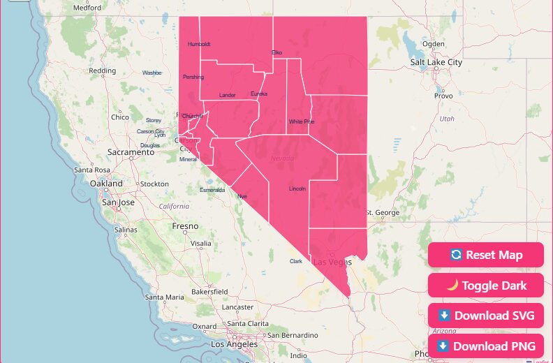
Hover and Highlight
Simply move your mouse cursor over any county on the map. The specific county will highlight, and a tooltip will appear displaying the county name and key data points.
Zoom In and Out
Use the scroll wheel on your mouse or the “+” and “–” buttons in the top corner of the map interface.
Reset Button
If you have zoomed in too far or moved the map off-center, click the “Reset” button to instantly return to the default statewide view.
Dark Mode Toggle
Working late or prefer a high-contrast interface? Toggle the “Dark Mode” switch to invert the colors, making the county borders pop against a dark background.
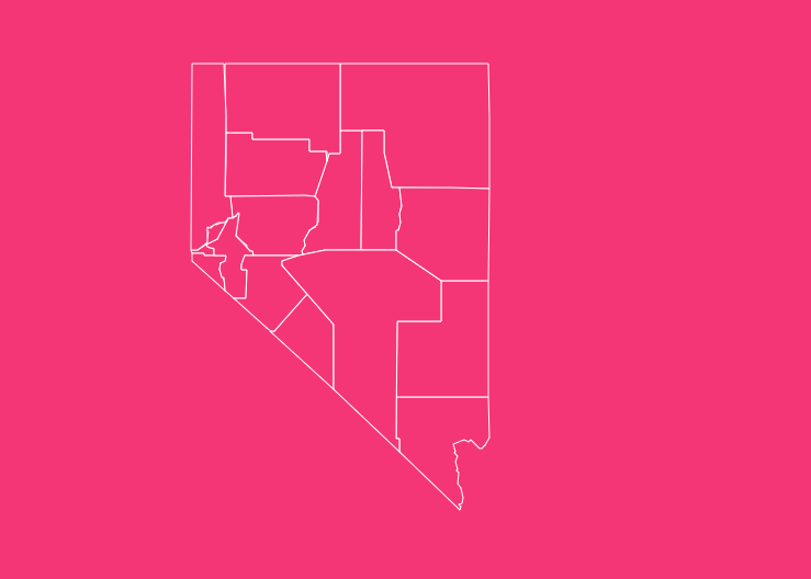
Download Options (Blank Printable SVG & PNG)
Sometimes you need a static map for a presentation, a classroom worksheet, or a report. We offer two distinct formats for free download.
Download PNG
This is a high-resolution image file perfect for inserting into Word documents, PowerPoint presentations, or blog posts. It comes with a transparent background for easy integration.
Download SVG
This Scalable Vector Graphic is ideal for graphic designers. You can open this file in software like Adobe Illustrator or Inkscape to change colors, adjust border thickness, and resize the map without losing any quality.
Geographical Overview of Nevada
To understand the map, you must understand the terrain. Nevada lies almost entirely within the Great Basin, a massive geographic bowl between the Sierra Nevada mountains to the west and the Wasatch Range to the east.
This unique geography creates the “Basin and Range” topography that defines most of the counties.
If you drive across the state on Highway 50 (the “Loneliest Road in America”), you will notice a repetitive pattern: a flat valley floor followed by a mountain range, repeated over and over again.
The South
Home to Clark County, this area is part of the Mojave Desert. It is lower in elevation, hotter, and holds the majority of the state’s population.
The West
Dominated by the Sierra Nevada mountains, this region includes Washoe County and Douglas County. It features alpine lakes and pine forests.
The Central and East
This is the heart of the “cow counties.” It is a high desert country, characterized by sagebrush, mining operations, and livestock grazing.
Historical Overview of County Formation
The lines drawn on the Nevada map are not random; they are historical artifacts of the mining booms of the 19th century.
When the Nevada Territory was first established in 1861, the legislature created nine original counties. As prospectors discovered new veins of silver and gold in different parts of the desert, the population would shift rapidly.
The legislature would often redraw county lines to ensure that local governments could tax the new mining wealth.
The final major change occurred in 1969 when Ormsby County and Carson City consolidated. This created the Consolidated Municipality of Carson City, giving it the unique status of being an independent city rather than a traditional county.
Why is County Data Important?
Why should you care about FIPS codes or county seats? For professionals and researchers, this granular data is vital.
Census Tracking
The federal government uses county boundaries to track population growth. In Nevada, the disparity is huge; Clark County grows rapidly, while some rural counties have seen populations plateau.
Resource Allocation
State funding for schools, roads, and emergency services is often distributed based on county-level data.
Business Logistics
Companies use these boundaries to determine sales territories, shipping zones, and tax jurisdictions.
Real Estate
Property taxes and zoning laws are determined at the county level, making this map crucial for developers and homebuyers.
Important Nevada County Insights
Before diving into the full data list, let’s look at the standout counties that define the state.
Clark County
This is the economic engine of Nevada. Home to Las Vegas, Henderson, and North Las Vegas, Clark County holds nearly three-quarters of the state’s entire population. It is a global hub for tourism, hospitality, and conventions.
Washoe County
Located in the northwest, Washoe County is the state’s second major population center. It anchors the “Reno-Sparks” metropolitan area.
Geographically, it stretches north to the Oregon border, covering vast expanses of high desert conservation areas.
Nye County
Nye County is the third-largest county by area in the contiguous United States. It is massive larger than the states of Maryland, Delaware, Vermont, and New Hampshire combined.
Despite its size, it has a low population density and is home to the Nevada National Security Site.
Elko County
Sitting in the northeast corner, Elko County is the heart of Nevada’s gold mining industry. It is culturally distinct, with a strong heritage of ranching and Basque culture.
List of Nevada Counties
Below is the complete dataset for all 16 counties and the independent city. We have included the Federal Information Processing Standard (FIPS) code, which is essential for data identification.
| County Name | FIPS Code | County Seat | Established Year |
| Carson City | 510 | (Independent City) | 1969 |
| Churchill County | 001 | Fallon | 1861 |
| Clark County | 003 | Las Vegas | 1909 |
| Douglas County | 005 | Minden | 1861 |
| Elko County | 007 | Elko | 1869 |
| Esmeralda County | 009 | Goldfield | 1861 |
| Eureka County | 011 | Eureka | 1873 |
| Humboldt County | 013 | Winnemucca | 1861 |
| Lander County | 015 | Battle Mountain | 1862 |
| Lincoln County | 017 | Pioche | 1866 |
| Lyon County | 019 | Yerington | 1861 |
| Mineral County | 021 | Hawthorne | 1911 |
| Nye County | 023 | Tonopah | 1864 |
| Pershing County | 027 | Lovelock | 1919 |
| Storey County | 029 | Virginia City | 1861 |
| Washoe County | 031 | Reno | 1861 |
| White Pine County | 033 | Ely | 1869 |
Frequently Asked Questions
How many counties are in Nevada?
Nevada consists of 16 counties and one independent city (Carson City), totaling 17 county-equivalent entities.
What is the largest county in Nevada by size?
Nye County is the largest by area, covering approximately 18,159 square miles. It is one of the largest counties in the entire United States.
Which Nevada county has the highest population?
Clark County is the most populous, home to over 2.2 million residents, which accounts for the vast majority of the state’s population.
What is the smallest county in Nevada?
Storey County is the smallest by land area, covering only about 264 square miles. It is historically significant for the silver mining boom.
Which county is the capital city located in?
The state capital, Carson City, is not located within a county. It is an independent city that functions as both a city and a county.
What is the oldest county in Nevada?
Several counties were established simultaneously when the Nevada Territory was formed in 1861, including Churchill, Douglas, Esmeralda, Humboldt, Lyon, Storey, and Washoe.
What is the newest county in Nevada?
Pershing County is the youngest county in the state, carved out of Humboldt County in 1919.
Which Nevada county is the least populated?
Esmeralda County is typically the least populated, often recording fewer than 1,000 residents in census data.
What are FIPS codes used for?
FIPS (Federal Information Processing Standards) codes are unique numeric identifiers used by the Census Bureau to track data. Nevada’s state code is 32, and each county has a unique three-digit suffix (e.g., Clark County is 003).
Does Nevada have any “dry” counties?
No, Nevada does not have any dry counties where the sale of alcohol is prohibited. However, local regulations regarding the hours of sale may vary slightly outside the major tourist hubs.
Explore Nevada Today
Whether you are analyzing the booming growth of Clark County or the vast, quiet beauty of Nye County, these boundaries shape life in the Silver State.
Ready to use this map for your project? Scroll back up to download your free high-resolution SVG or PNG map now.