Indiana, known as the “Crossroads of America,” is a state defined by its intricate grid of communities and local governments.
Navigating this landscape requires a deep understanding of its political geography.
Whether you are a real estate developer, a student of history, or a business analyst, understanding the Indiana county map is essential for interpreting demographic trends and administrative boundaries.
How to Use the Map Tool on This Page
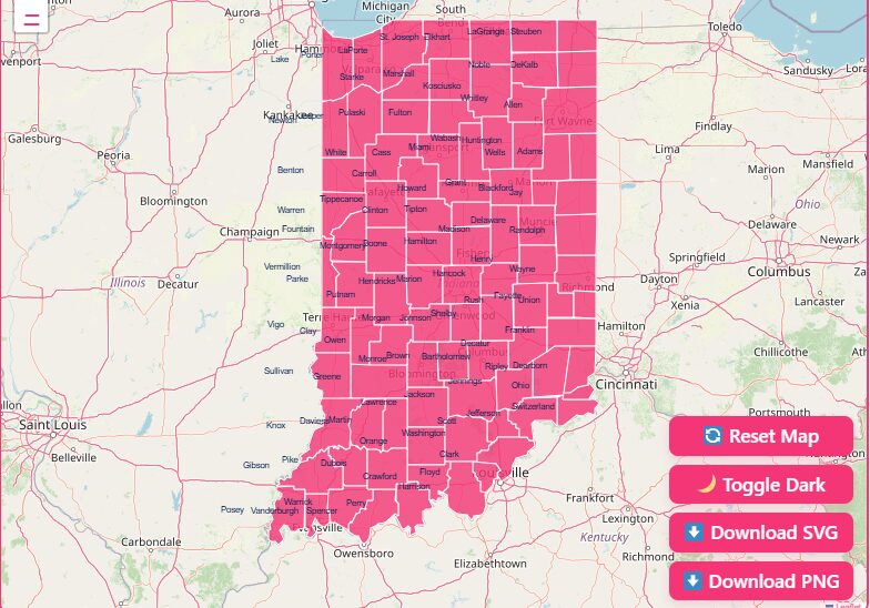
We have designed our Indiana county map tool to be as intuitive and versatile as possible.
Whether you need a quick visual reference or a high-resolution file for a presentation, here is how to get the most out of the interactive features:
Hover Highlight
Simply move your mouse cursor over any county on the map. The specific county will instantly highlight, displaying its name and key data points in a tooltip.
Zoom In/Out
Use the + and – buttons in the corner of the map (or your mouse scroll wheel) to focus on specific regions, such as the Indianapolis metropolitan area or the rural southern border.
Dark Mode Toggle
Working late or prefer a high-contrast view? Click the “Moon” icon to switch the map interface to Dark Mode, reducing eye strain and making boundary lines pop.
Reset Button
If you have zoomed in too far or lost your orientation, hit the “Reset” button to instantly return the map to the full state view.
Download Options
Need to take the map offline? We offer flexible download formats for your convenience:
Blank Printable SVG
Ideal for graphic designers and students who need a scalable vector file for projects or coloring.
High-Res PNG
Perfect for inserting directly into reports, PowerPoint presentations, or blog posts.
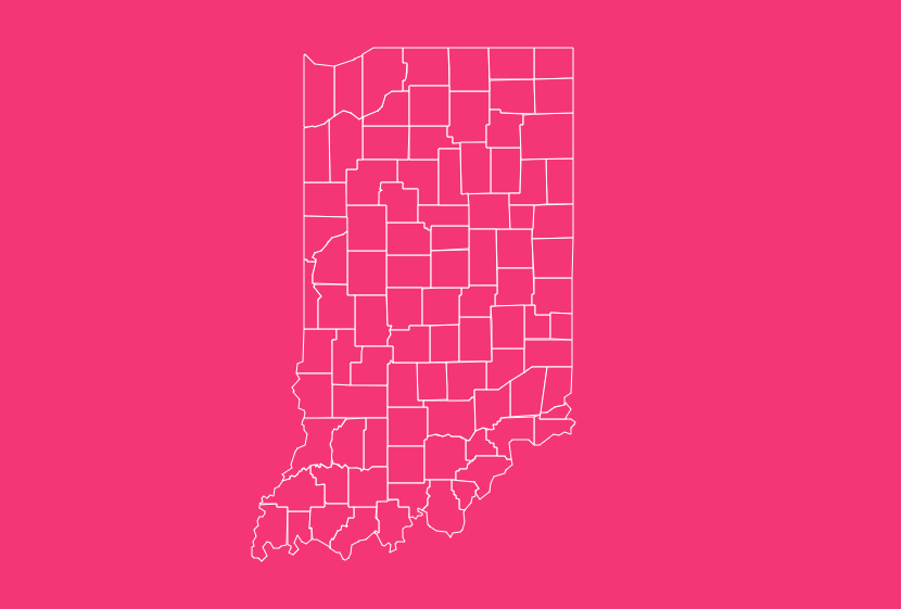
Geographical Overview of Indiana
Indiana’s geography is administratively divided into 92 counties, a relatively high number compared to the state’s total land area of 36,418 square miles.
This density reflects the 19th-century goal of ensuring that every resident lived within a day’s horse-and-buggy ride of their county seat.
Important Indiana County Insights
When analyzing the state’s geography, several extremes stand out regarding population and size.
Population Extremes
Most Populous
Marion County, home to Indianapolis, dominates the demographic landscape with a population of approximately 977,203 (based on 2020 Census data).
It serves as the economic and cultural engine of the state.
Least Populous
Ohio County, located along the river in the southeast, holds the title for the smallest population, with roughly 5,940 residents.
Land Area Extremes
Largest County
Allen County in northeastern Indiana covers 657.3 square miles, making it the largest by land area. It houses Fort Wayne, the state’s second-largest city.
Smallest County
Ohio County is not only the least populated but also the smallest geographically, covering just 86.1 square miles.
Historical Overview of County Formation
The boundaries you see today are the result of decades of legislation, treaties, and surveying.
The Beginning (1790)
The story of Indiana’s counties begins before statehood.
Knox County was the first to be organized in 1790, encompassing a massive area of the Northwest Territory that included parts of modern-day Illinois and Michigan.
It was named after General Henry Knox, the first U.S. Secretary of War.
The Expansion (1816–1859)
When Indiana was granted statehood in 1816, the southern third of the state was already divided into counties.
As the native population was displaced and treaties opened up central and northern Indiana to settlement, new counties were rapidly formed.
Naming Conventions
Many counties were named after Revolutionary War heroes (Clark, Greene, Wayne), Founding Fathers (Adams, Jefferson, Madison), or local Native American tribes (Miami, Delaware, Elkhart).
The Final County
The map as we know it was largely finalized in 1859 with the creation of Newton County, the last of the 92 counties to be organized.
The Importance of Accurate County Data
Why do accurate county boundaries matter? Beyond simple geography, county lines dictate:
- Jurisdiction: Which sheriff’s department responds to an emergency.
- Taxation: Property tax rates and school district funding.
- Representation: Voting districts and political representation.
List of Indiana Counties
Below is the complete reference table for all 92 counties in Indiana. Use this table to find the FIPS code, county seat, and the year each county was legally established.
| County Name | FIPS Code | County Seat | Established Year |
| Adams | 18001 | Decatur | 1836 |
| Allen | 18003 | Fort Wayne | 1824 |
| Bartholomew | 18005 | Columbus | 1821 |
| Benton | 18007 | Fowler | 1840 |
| Blackford | 18009 | Hartford City | 1838 |
| Boone | 18011 | Lebanon | 1830 |
| Brown | 18013 | Nashville | 1836 |
| Carroll | 18015 | Delphi | 1828 |
| Cass | 18017 | Logansport | 1829 |
| Clark | 18019 | Jeffersonville | 1801 |
| Clay | 18021 | Brazil | 1825 |
| Clinton | 18023 | Frankfort | 1830 |
| Crawford | 18025 | English | 1818 |
| Daviess | 18027 | Washington | 1817 |
| Dearborn | 18029 | Lawrenceburg | 1803 |
| Decatur | 18031 | Greensburg | 1822 |
| DeKalb | 18033 | Auburn | 1837 |
| Delaware | 18035 | Muncie | 1827 |
| Dubois | 18037 | Jasper | 1818 |
| Elkhart | 18039 | Goshen | 1830 |
| Fayette | 18041 | Connersville | 1819 |
| Floyd | 18043 | New Albany | 1819 |
| Fountain | 18045 | Covington | 1826 |
| Franklin | 18047 | Brookville | 1811 |
| Fulton | 18049 | Rochester | 1836 |
| Gibson | 18051 | Princeton | 1813 |
| Grant | 18053 | Marion | 1831 |
| Greene | 18055 | Bloomfield | 1821 |
| Hamilton | 18057 | Noblesville | 1823 |
| Hancock | 18059 | Greenfield | 1828 |
| Harrison | 18061 | Corydon | 1808 |
| Hendricks | 18063 | Danville | 1824 |
| Henry | 18065 | New Castle | 1822 |
| Howard | 18067 | Kokomo | 1844 |
| Huntington | 18069 | Huntington | 1832 |
| Jackson | 18071 | Brownstown | 1816 |
| Jasper | 18073 | Rensselaer | 1838 |
| Jay | 18075 | Portland | 1836 |
| Jefferson | 18077 | Madison | 1811 |
| Jennings | 18079 | Vernon | 1817 |
| Johnson | 18081 | Franklin | 1823 |
| Knox | 18083 | Vincennes | 1790 |
| Kosciusko | 18085 | Warsaw | 1836 |
| LaGrange | 18087 | LaGrange | 1832 |
| Lake | 18089 | Crown Point | 1837 |
| LaPorte | 18091 | LaPorte | 1832 |
| Lawrence | 18093 | Bedford | 1818 |
| Madison | 18095 | Anderson | 1823 |
| Marion | 18097 | Indianapolis | 1822 |
| Marshall | 18099 | Plymouth | 1836 |
| Martin | 18101 | Shoals | 1820 |
| Miami | 18103 | Peru | 1834 |
| Monroe | 18105 | Bloomington | 1818 |
| Montgomery | 18107 | Crawfordsville | 1823 |
| Morgan | 18109 | Martinsville | 1822 |
| Newton | 18111 | Kentland | 1859 |
| Noble | 18113 | Albion | 1836 |
| Ohio | 18115 | Rising Sun | 1844 |
| Orange | 18117 | Paoli | 1816 |
| Owen | 18119 | Spencer | 1819 |
| Parke | 18121 | Rockville | 1821 |
| Perry | 18123 | Tell City | 1814 |
| Pike | 18125 | Petersburg | 1817 |
| Porter | 18127 | Valparaiso | 1836 |
| Posey | 18129 | Mount Vernon | 1814 |
| Pulaski | 18131 | Winamac | 1839 |
| Putnam | 18133 | Greencastle | 1822 |
| Randolph | 18135 | Winchester | 1818 |
| Ripley | 18137 | Versailles | 1816 |
| Rush | 18139 | Rushville | 1822 |
| St. Joseph | 18141 | South Bend | 1830 |
| Scott | 18143 | Scottsburg | 1820 |
| Shelby | 18145 | Shelbyville | 1822 |
| Spencer | 18147 | Rockport | 1818 |
| Starke | 18149 | Knox | 1850 |
| Steuben | 18151 | Angola | 1837 |
| Sullivan | 18153 | Sullivan | 1817 |
| Switzerland | 18155 | Vevay | 1814 |
| Tippecanoe | 18157 | Lafayette | 1826 |
| Tipton | 18159 | Tipton | 1844 |
| Union | 18161 | Liberty | 1821 |
| Vanderburgh | 18163 | Evansville | 1818 |
| Vermillion | 18165 | Newport | 1824 |
| Vigo | 18167 | Terre Haute | 1818 |
| Wabash | 18169 | Wabash | 1835 |
| Warren | 18171 | Williamsport | 1827 |
| Warrick | 18173 | Boonville | 1813 |
| Washington | 18175 | Salem | 1814 |
| Wayne | 18177 | Richmond | 1811 |
| Wells | 18179 | Bluffton | 1837 |
| White | 18181 | Monticello | 1834 |
| Whitley | 18183 | Columbia City | 1838 |
Frequently Asked Questions
How many counties are in Indiana?
There are 92 counties in Indiana. This number has remained stable since the final county, Newton County, was established in 1859.
Which Indiana county has the largest land area?
Allen County is the largest by land area, occupying 657.3 square miles.
Which Indiana county is the smallest?
Ohio County is the smallest by both land area (86.1 square miles) and population.
What is the most populated county in Indiana?
According to the 2020 Census, Marion County is the most populated, with 977,203 residents.
What is the FIPS code structure for Indiana counties?
Indiana’s state FIPS code is 18. County codes are three digits (e.g., Adams County is 001). Combined, the full unique identifier for Adams County is 18001.
Which was the first county established in Indiana?
Knox County was established first in 1790, well before Indiana became a state in 1816.
Which was the last county formed in Indiana?
Newton County was the final county to be organized, established in 1859.
Why does Indiana have 92 counties?
The high number of counties was designed in the 19th century to ensure that any citizen could travel to their county seat (administrative center) and return home within a single day using a horse and buggy.
What data source is used for these county boundaries?
The boundaries are sourced from the Indiana Geographic Information Office (IGIO), specifically the “County Boundaries of Indiana Current” dataset, which was compiled from 2021 submissions and topologically corrected.
Are there any counties with the same name as other US counties?
Yes, many. For example, there are 18 “Clark” counties and 26 “Franklin” counties across the United States. This is why standardized FIPS codes are necessary for data differentiation.
How many counties in Indiana are part of the Chicago metropolitan area?
Several counties in Northwest Indiana, including Lake, Porter, Newton, and Jasper, are often associated with the Chicago metropolitan statistical area due to their economic ties and commuting patterns.
Conclusion
Whether you are using the interactive features to zoom into a specific township or downloading the high-resolution files for a project, we hope this guide has provided the clarity you need.
[Download Your Free High-Res Indiana County Map].