From the bustling streets of Philadelphia to the quiet, elk-roaming forests of the Pennsylvania Wilds, the Keystone State offers a landscape of incredible diversity.
Navigating this complex geography requires more than just a list of names; it requires a deep understanding of the political and physical boundaries that shape the state.
How to Use the Interactive Tool on This Page
Hover and Highlight
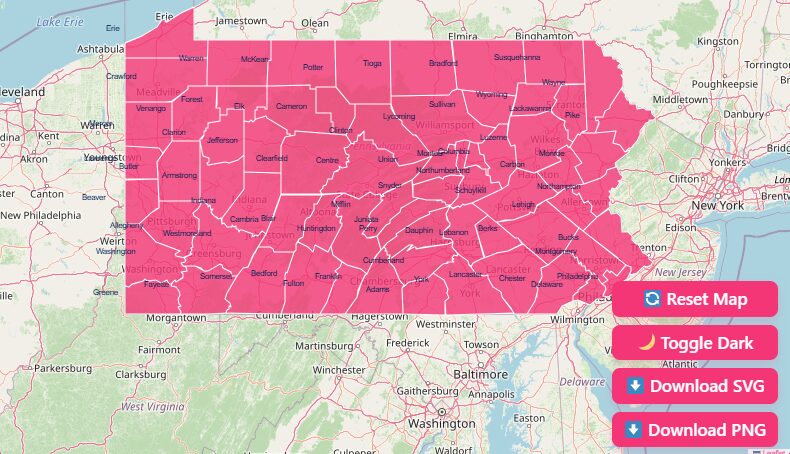
Simply move your mouse cursor (or tap with your finger on mobile) over any county. The specific county will highlight, instantly displaying its name and key data points.
Zoom In and Out
Need a closer look at the clustered counties near Philadelphia or Pittsburgh? Use the + and – buttons in the corner of the map, or use the scroll wheel on your mouse to zoom in for a granular view of borders and topography.
Dark Mode Toggle
If you are working late or simply prefer a high-contrast interface, click the “Dark Mode” toggle. This switches the map background to a dark slate color, making the county outlines pop in neon contrast.
Reset Button
If you have zoomed in too far or lost your orientation, hit the “Reset” button to instantly snap the map back to the full state view.
Download Options: Taking the Map Offline
Blank Printable Map
Ideal for classrooms and quizzes. This clean outline contains borders without text, perfect for geography exercises.
SVG (Scalable Vector Graphics)
Designed for graphic designers and publishers. This format allows you to resize the map infinitely without losing quality, making it perfect for large-format printing or professional web design.
PNG Image
A standard, high-quality image file ready to be inserted into Word documents, PowerPoint presentations, or blog posts.
Historical Overview: How Pennsylvania’s Counties Were Formed
The map of Pennsylvania did not always look like the patchwork of 67 counties we see today. The evolution of these boundaries is a story of expansion, politics, and population growth.
The Original Three (1682)
When William Penn founded the province, he established the first three counties to organize the government and courts.
These original counties Philadelphia, Bucks, and Chester anchored the southeast corner of the state and served as the launching point for westward expansion.
The “Mother of Counties”
As settlers moved inward along the Susquehanna River, the need for local governance grew. Northumberland County, formed in 1772, originally covered a massive expanse of central and northern Pennsylvania.
Because so many modern counties were eventually carved out of its original territory, it is affectionately known as the “Mother of Counties.”
The Final Piece (1878)
The county map remained fluid for nearly two centuries. The final addition to the map occurred in 1878, when Lackawanna County was carved out of Luzerne County due to the booming anthracite coal industry and the rapid industrialization of Scranton.
Since then, the map has remained fixed at 67 counties.
Geographical Overview: Regions of the Keystone State
Understanding the county map helps to visualize the distinct physiographic regions of the state. Pennsylvania is far from a monolith; it is a collection of diverse landscapes.
The Southeast and Piedmont
Dominated by Philadelphia, Delaware, Chester, Montgomery, and Bucks counties, this region is the economic engine of the state. Geographically, it sits on the Piedmont plateau, offering rolling hills and fertile soil that transitions into the dense urban corridor.
The Ridge and Valley
Moving inward, you encounter the Appalachian Mountains.
Counties like Dauphin, Centre, and Lycoming are defined by long, parallel mountain ridges separated by fertile valleys. This topography dictated early migration patterns and remains visually striking on topographic maps.
The Allegheny Plateau
Covering the western and northern tiers including Allegheny, Erie, and Potter counties, this vast plateau features deep river valleys and rugged terrain.
It is home to the state’s industrial steel heritage in the southwest and the dense hardwood forests in the north.
Why County Data Matters
Why do we put so much emphasis on county lines? In Pennsylvania, the county is a critical unit of measurement and governance.
Government Funding
State and federal grants are often allocated based on county-level census data.
Legal Jurisdiction
The Court of Common Pleas acts at the county level. Knowing which county you are in determines which laws and courts apply to you.
Business Logistics
For logistics companies and marketers, county lines determine delivery zones, sales territories, and media markets.
Genealogy
Vital records (birth, death, marriage) are archived at the county level. Knowing the “parent” county of a region at a specific date is crucial for tracing family history.
List of Pennsylvania Counties
The following table provides a comprehensive reference for all 67 counties, including their Federal Information Processing Standards (FIPS) code, county seat, and the year they were legally established.
| County Name | FIPS Code | County Seat | Established |
| Adams | 42001 | Gettysburg | 1800 |
| Allegheny | 42003 | Pittsburgh | 1788 |
| Armstrong | 42005 | Kittanning | 1800 |
| Beaver | 42007 | Beaver | 1800 |
| Bedford | 42009 | Bedford | 1771 |
| Berks | 42011 | Reading | 1752 |
| Blair | 42013 | Hollidaysburg | 1846 |
| Bradford | 42015 | Towanda | 1810 |
| Bucks | 42017 | Doylestown | 1682 |
| Butler | 42019 | Butler | 1800 |
| Cambria | 42021 | Ebensburg | 1804 |
| Cameron | 42023 | Emporium | 1860 |
| Carbon | 42025 | Jim Thorpe | 1843 |
| Centre | 42027 | Bellefonte | 1800 |
| Chester | 42029 | West Chester | 1682 |
| Clarion | 42031 | Clarion | 1839 |
| Clearfield | 42033 | Clearfield | 1804 |
| Clinton | 42035 | Lock Haven | 1839 |
| Columbia | 42037 | Bloomsburg | 1813 |
| Crawford | 42039 | Meadville | 1800 |
| Cumberland | 42041 | Carlisle | 1750 |
| Dauphin | 42043 | Harrisburg | 1785 |
| Delaware | 42045 | Media | 1789 |
| Elk | 42047 | Ridgway | 1843 |
| Erie | 42049 | Erie | 1800 |
| Fayette | 42051 | Uniontown | 1783 |
| Forest | 42053 | Tionesta | 1848 |
| Franklin | 42055 | Chambersburg | 1784 |
| Fulton | 42057 | McConnellsburg | 1850 |
| Greene | 42059 | Waynesburg | 1796 |
| Huntingdon | 42061 | Huntingdon | 1787 |
| Indiana | 42063 | Indiana | 1803 |
| Jefferson | 42065 | Brookville | 1804 |
| Juniata | 42067 | Mifflintown | 1831 |
| Lackawanna | 42069 | Scranton | 1878 |
| Lancaster | 42071 | Lancaster | 1729 |
| Lawrence | 42073 | New Castle | 1849 |
| Lebanon | 42075 | Lebanon | 1813 |
| Lehigh | 42077 | Allentown | 1812 |
| Luzerne | 42079 | Wilkes-Barre | 1786 |
| Lycoming | 42081 | Williamsport | 1795 |
| McKean | 42083 | Smethport | 1804 |
| Mercer | 42085 | Mercer | 1800 |
| Mifflin | 42087 | Lewistown | 1789 |
| Monroe | 42089 | Stroudsburg | 1836 |
| Montgomery | 42091 | Norristown | 1784 |
| Montour | 42093 | Danville | 1850 |
| Northampton | 42095 | Easton | 1752 |
| Northumberland | 42097 | Sunbury | 1772 |
| Perry | 42099 | New Bloomfield | 1820 |
| Philadelphia | 42101 | Philadelphia | 1682 |
| Pike | 42103 | Milford | 1814 |
| Potter | 42105 | Coudersport | 1804 |
| Schuylkill | 42107 | Pottsville | 1811 |
| Snyder | 42109 | Middleburg | 1855 |
| Somerset | 42111 | Somerset | 1795 |
| Sullivan | 42113 | Laporte | 1847 |
| Susquehanna | 42115 | Montrose | 1810 |
| Tioga | 42117 | Wellsboro | 1804 |
| Union | 42119 | Lewisburg | 1813 |
| Venango | 42121 | Franklin | 1800 |
| Warren | 42123 | Warren | 1800 |
| Washington | 42125 | Washington | 1781 |
| Wayne | 42127 | Honesdale | 1798 |
| Westmoreland | 42129 | Greensburg | 1773 |
| Wyoming | 42131 | Tunkhannock | 1843 |
| York | 42133 | York | 1749 |
Important Pennsylvania County Insights
When analyzing the map, certain counties stand out due to their statistical extremes. These insights are vital for anyone looking to understand the population distribution of the state.
Most Populous
Philadelphia County reigns supreme with over 1.5 million residents, acting as the state’s cultural and economic hub.
Least Populous
Cameron County holds the distinction of having the smallest population, with fewer than 4,500 residents. It is known for its rugged wilderness and outdoor activities.
Largest by Area
Lycoming County, located in central PA, covers the most ground, spanning 1,244 square miles.
Smallest by Area
Montour County is the smallest landmass, covering just 132 square miles.
Frequently Asked Questions
How many counties are in Pennsylvania?
There are exactly 67 counties in the Commonwealth of Pennsylvania.
Which are the three original counties?
Philadelphia, Bucks, and Chester counties were all established in 1682 by William Penn.
What is the newest county in PA?
Lackawanna County is the youngest, established in 1878 after splitting from Luzerne County.
What is the FIPS code prefix for Pennsylvania?
The state code for Pennsylvania is 42. All county FIPS codes begin with 42, followed by a unique three-digit identifier (e.g., Adams County is 42001).
Which county contains the highest point in the state?
Somerset County is home to Mount Davis, the highest point in Pennsylvania at 3,213 feet above sea level.
Which county contains the lowest point in the state?
Delaware County (and Philadelphia) sits along the Delaware River, which is at sea level.
Why is Pennsylvania called a Commonwealth?
Pennsylvania is one of four states (along with Kentucky, Massachusetts, and Virginia) designated as a Commonwealth.
Legally, there is no difference between a state and a commonwealth; the term emphasizes that the government is based on the common consent of the people.
Which county is known as the “Mother of Counties”?
Northumberland County originally covered a vast area of the state, and over 30 other counties were eventually carved from its land.
What is the capital of Pennsylvania and which county is it in?
The state capital is Harrisburg, which is located in Dauphin County.
Which county has the most municipalities?
Allegheny County has the most municipalities (130), reflecting the dense, fragmented governmental structure surrounding Pittsburgh.
Start Exploring Today
Use the interactive tool above to gain immediate insights, or download our high-resolution maps to take your research offline.
If you need specific datasets or have questions about regional boundaries, feel free to contact our support team for assistance.