Illinois is often defined by its most famous city, but look beyond the skyline of Chicago, and you will find a complex patchwork of 102 distinct counties.
From the rolling hills of the Shawnee National Forest in the south to the driftless areas in the northwest, the state’s administrative boundaries tell a story of rapid expansion, political evolution, and diverse geography.
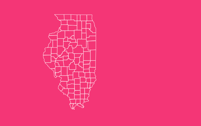
How to Use the Interactive Map Tool
Here is how you can get the most out of the features:

Hover Highlight
Simply move your mouse over any county to instantly highlight its border. This triggers a tooltip displaying the county name and key data points, allowing for quick scanning without clicking.
Zoom Capability
Need to see the intricate borders along the Mississippi or Wabash rivers? Use the scroll wheel on your mouse or the + and – buttons in the corner of the map interface to zoom in and out.
Dark Mode Toggle
If you are working late or prefer high-contrast visuals, click the “Moon” icon. This switches the map to Dark Mode, making outlines pop against a dark background, perfect for reducing eye strain.
Reset View
If you have zoomed in too far or lost your orientation, hit the “Reset” button to instantly snap the map back to the full state view.
Download Options
We offer flexible formats for your needs.
Download SVG
Best for graphic designers and publishers. This vector format allows you to resize the map infinitely without quality loss.
Download PNG
Ideal for slide decks, reports, and quick sharing. This gives you a high-resolution raster image of the current map state.
Geographical Overview of Illinois
Illinois acts as a microcosm of the United States, bridging the industrial North with the agricultural South. Geographically, the county lines are often dictated by the state’s major waterways.
The western border is entirely defined by the Mississippi River, carving out the edges of counties like Adams, Pike, and Rock Island.
To the south and southeast, the Ohio River and Wabash River separate Illinois from Kentucky and Indiana.
While the northern counties are heavily glaciated and flat, ideal for the grid-like expansion of Chicago’s collar counties, the southern tip, known as “Little Egypt,” features rugged terrain and the Ozark foothills.
Understanding this geography helps explain why some counties, like McLean, are massive squares of farmland, while others along the rivers have irregular, winding boundaries.
Historical Overview of County Formation
The map of Illinois did not always look this crowded. The formation of these 102 counties was a gradual process spanning nearly 70 years.
The Early Years (1790–1818)
Before statehood, the area was part of the Northwest Territory. St. Clair County was the very first to be organized in 1790.
By the time Illinois became a state in 1818, there were only 15 counties, most of them clustering in the southern portion of the territory.
The Expansion Era (1819–1839)
As settlers moved northward, new counties were carved out of larger tracts of land. The peak of this activity occurred in 1839, when 15 new counties were formed in a single year, a record that still stands.
The Final Piece (1859)
The map remained in flux until Ford County was established in 1859. Since then, the internal boundaries of Illinois have remained static, giving us the 102 counties we recognize today.
Important Illinois County Insights
When analyzing the map, a few counties stand out for their statistical and geographical significance.
Cook County
Home to Chicago, this is the economic engine of the state. It is the second-most populous county in the entire United States.
McLean County
Located in central Illinois, McLean holds the title for the largest land area, covering roughly 1,183 square miles.
Putnam County
In stark contrast to McLean, Putnam is the smallest county by land area, occupying just 160 square miles.
Hardin County
Tucked away in the southeast, Hardin typically registers as the least populous county in the state.
The Importance of County Data
Why does this data matter? County lines are the primary unit for a vast array of American record-keeping.
Census & Demographics
The U.S. Census Bureau uses FIPS (Federal Information Processing Standards) codes to track population shifts.
If you are researching genealogy or local history, knowing the correct county and when it was formed is vital for finding vital records.
Electoral Analysis
Illinois is politically diverse. Analyzing voting patterns at the county level reveals the granular divide between urban centers and rural districts.
Urban Planning
State funding for infrastructure, from road repair to school districts, is often allocated based on county-level data.
List of Illinois Counties
Below is a reference table containing all 102 counties, their FIPS codes, county seats, and the year they were established.
| County Name | FIPS Code | County Seat | Established |
| Adams | 17001 | Quincy | 1825 |
| Alexander | 17003 | Cairo | 1819 |
| Bond | 17005 | Greenville | 1817 |
| Boone | 17007 | Belvidere | 1837 |
| Brown | 17009 | Mount Sterling | 1839 |
| Bureau | 17011 | Princeton | 1837 |
| Calhoun | 17013 | Hardin | 1825 |
| Carroll | 17015 | Mount Carroll | 1839 |
| Cass | 17017 | Virginia | 1837 |
| Champaign | 17019 | Urbana | 1833 |
| Christian | 17021 | Taylorville | 1839 |
| Clark | 17023 | Marshall | 1819 |
| Clay | 17025 | Louisville | 1824 |
| Clinton | 17027 | Carlyle | 1824 |
| Coles | 17029 | Charleston | 1830 |
| Cook | 17031 | Chicago | 1831 |
| Crawford | 17033 | Robinson | 1816 |
| Cumberland | 17035 | Toledo | 1843 |
| DeKalb | 17037 | Sycamore | 1837 |
| DeWitt | 17039 | Clinton | 1839 |
| Douglas | 17041 | Tuscola | 1859 |
| DuPage | 17043 | Wheaton | 1839 |
| Edgar | 17045 | Paris | 1823 |
| Edwards | 17047 | Albion | 1814 |
| Effingham | 17049 | Effingham | 1831 |
| Fayette | 17051 | Vandalia | 1821 |
| Ford | 17053 | Paxton | 1859 |
| Franklin | 17055 | Benton | 1818 |
| Fulton | 17057 | Lewistown | 1823 |
| Gallatin | 17059 | Shawneetown | 1812 |
| Greene | 17061 | Carrollton | 1821 |
| Grundy | 17063 | Morris | 1841 |
| Hamilton | 17065 | McLeansboro | 1821 |
| Hancock | 17067 | Carthage | 1825 |
| Hardin | 17069 | Elizabethtown | 1839 |
| Henderson | 17071 | Oquawka | 1841 |
| Henry | 17073 | Cambridge | 1825 |
| Iroquois | 17075 | Watseka | 1833 |
| Jackson | 17077 | Murphysboro | 1816 |
| Jasper | 17079 | Newton | 1831 |
| Jefferson | 17081 | Mount Vernon | 1819 |
| Jersey | 17083 | Jerseyville | 1839 |
| Jo Daviess | 17085 | Galena | 1827 |
| Johnson | 17087 | Vienna | 1812 |
| Kane | 17089 | Geneva | 1836 |
| Kankakee | 17091 | Kankakee | 1853 |
| Kendall | 17093 | Yorkville | 1841 |
| Knox | 17095 | Galesburg | 1825 |
| Lake | 17097 | Waukegan | 1839 |
| LaSalle | 17099 | Ottawa | 1831 |
| Lawrence | 17101 | Lawrenceville | 1821 |
| Lee | 17103 | Dixon | 1839 |
| Livingston | 17105 | Pontiac | 1837 |
| Logan | 17107 | Lincoln | 1839 |
| Macon | 17115 | Decatur | 1829 |
| Macoupin | 17117 | Carlinville | 1829 |
| Madison | 17119 | Edwardsville | 1812 |
| Marion | 17121 | Salem | 1823 |
| Marshall | 17123 | Lacon | 1839 |
| Mason | 17125 | Havana | 1841 |
| Massac | 17127 | Metropolis | 1843 |
| McDonough | 17109 | Macomb | 1826 |
| McHenry | 17111 | Woodstock | 1836 |
| McLean | 17113 | Bloomington | 1830 |
| Menard | 17129 | Petersburg | 1839 |
| Mercer | 17131 | Aledo | 1825 |
| Monroe | 17133 | Waterloo | 1816 |
| Montgomery | 17135 | Hillsboro | 1821 |
| Morgan | 17137 | Jacksonville | 1823 |
| Moultrie | 17139 | Sullivan | 1843 |
| Ogle | 17141 | Oregon | 1836 |
| Peoria | 17143 | Peoria | 1825 |
| Perry | 17145 | Pinckneyville | 1827 |
| Piatt | 17147 | Monticello | 1841 |
| Pike | 17149 | Pittsfield | 1821 |
| Pope | 17151 | Golconda | 1816 |
| Pulaski | 17153 | Mound City | 1843 |
| Putnam | 17155 | Hennepin | 1825 |
| Randolph | 17157 | Chester | 1795 |
| Richland | 17159 | Olney | 1841 |
| Rock Island | 17161 | Rock Island | 1831 |
| Saline | 17165 | Harrisburg | 1847 |
| Sangamon | 17167 | Springfield | 1821 |
| Schuyler | 17169 | Rushville | 1825 |
| Scott | 17171 | Winchester | 1839 |
| Shelby | 17173 | Shelbyville | 1827 |
| St. Clair | 17163 | Belleville | 1790 |
| Stark | 17175 | Toulon | 1839 |
| Stephenson | 17177 | Freeport | 1837 |
| Tazewell | 17179 | Pekin | 1827 |
| Union | 17181 | Jonesboro | 1818 |
| Vermilion | 17183 | Danville | 1826 |
| Wabash | 17185 | Mount Carmel | 1824 |
| Warren | 17187 | Monmouth | 1825 |
| Washington | 17189 | Nashville | 1818 |
| Wayne | 17191 | Fairfield | 1819 |
| White | 17193 | Carmi | 1815 |
| Whiteside | 17195 | Morrison | 1836 |
| Will | 17197 | Joliet | 1836 |
| Williamson | 17199 | Marion | 1839 |
| Winnebago | 17201 | Rockford | 1836 |
| Woodford | 17203 | Eureka | 1841 |
Frequently Asked Questions
How many counties are there in Illinois?
There are exactly 102 counties in Illinois. This number has remained constant since 1859.
Which Illinois county is the largest by size?
McLean County is the largest by land area, covering approximately 1,183 square miles in central Illinois.
Which Illinois county has the highest population?
Cook County is the most populous, containing the city of Chicago. It is the second-most populous county in the entire U.S., following Los Angeles County, California.
What was the first county established in Illinois?
St. Clair County was established on April 27, 1790, nearly 30 years before Illinois was granted statehood.
Which county was the last to be formed?
Ford County was the final county to be created, established on February 17, 1859.
Why are there so many counties in Illinois?
Most counties were formed to ensure that residents could travel to the county seat and back within a single day on horseback. The rapid formation in the 1820s and 1830s also coincided with a population boom.
Is there a “Lincoln County” in Illinois?
Surprisingly, no. Despite being the “Land of Lincoln,” Illinois does not have a county named after Abraham Lincoln.
However, there is a Logan County (named after his friend Dr. John Logan) and a Douglas County (named after his political rival Stephen A. Douglas).
What is the smallest county in Illinois?
Putnam County is the smallest by land area, measuring just 160 square miles.
Do all counties operate under the same government structure?
No. Illinois counties operate under three types of governance: Township (83 counties), Commission (17 counties), and Executive (2 counties – Cook and Champaign).
Start Exploring Today
Understanding the layout of Illinois is critical for anyone dealing with regional data. Whether you are mapping out a sales territory, researching family history, or studying political boundaries, accuracy matters.
Ready to utilize this data for your own projects?
[Download the Free Illinois County Map].