Idaho is a land of rugged beauty, spanning from the Canadian border down to the high deserts of Nevada and Utah.
For researchers, business owners, and travelers, understanding the layout of the “Gem State” is essential.
While many people know the famous potatoes and the scenic Sawtooth Mountains, fewer understand the administrative backbone of the state: its 44 counties.
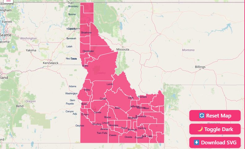
How to Use the Map Tool on This Page
Hover and Highlight
When you move your mouse cursor over specific regions of the map, the tool automatically highlights the county borders.
Zoom and Pan Capabilities
Idaho is geographically vast, covering over 83,000 square miles. To see smaller counties like Payette or Lewis clearly:
- Zoom In: Use the + button in the top corner or scroll up with your mouse wheel.
- Zoom Out: Use the – button or scroll down.
- Pan: Click and drag the map to move from the Panhandle down to the Magic Valley.
Reset View
If you have zoomed in too far or lost your orientation, simply hit the “Reset” button.
Dark Mode Toggle
For users working late or those who prefer high-contrast visuals, we offer a Dark Mode toggle.
Download Options
We understand that sometimes you need a static file for a presentation or report.
- SVG (Scalable Vector Graphics): Best for graphic designers and web developers who need to resize the map without losing quality.
- PNG (Portable Network Graphics): Ideal for standard documents, slideshows, and quick printing.
Historical Overview of Idaho Counties
While a modern map shows fixed borders, the story of Idaho’s counties is one of constant evolution.
Understanding this history reveals how the state transformed from a wild frontier territory into a structured political entity.
Early County Formations (The Territorial Days)
In March 1863, the Idaho Territory was organized. At that time, it was a massive expanse of land that included parts of modern-day Montana and Wyoming.
The very first county organized was Owyhee County in December 1863. It was quickly followed by Oneida, Nez Perce, Idaho, and Boise counties in early 1864.
These early borders were drawn largely based on mining camps and the gold rush. The population centers were transient, booming when gold was found and becoming ghost towns shortly after.
As a result, early county lines were fluid and often covered thousands of square miles of wilderness.
County Development Over Time
As the gold rush subsided and agriculture took over, the need for smaller, more manageable administrative districts grew.
1868
Idaho’s present-day external boundaries were established.
1890
Idaho was admitted to the Union as the 43rd state. At this time, there were only 18 counties.
The Boom (1911–1919)
As irrigation projects turned the southern desert into farmland and railroads connected the north, the population surged.
This era saw the most rapid creation of new counties. 21 new counties were carved out of existing ones during this eight-year window.
The Final Piece
Caribou County was the last to be created in 1919, finalizing the map of 44 counties we see today.
Geographical Overview of Idaho
Idaho is unique in its shape. It is wide at the bottom, bordering Nevada and Utah, and tapers to a narrow chimney at the top, bordering Canada.
This geography creates distinct regions, each with its own economic and cultural identity.
The Panhandle
Dominated by lakes and forests, this northern region is anchored by Coeur d’Alene and Sandpoint.
North Central
A rugged, mountainous area home to the Clearwater River and vast wilderness.
Southwestern (Treasure Valley)
The population hub of the state, containing Boise, Nampa, and Meridian.
South Central (Magic Valley)
An agricultural powerhouse defined by the Snake River Canyon.
Eastern Idaho
High desert and mountain ranges, heavily influenced by its proximity to Yellowstone and Grand Teton National Parks.
Individual County Profiles
To help you understand the diversity of the state, here are profiles of key counties that drive Idaho’s economy and culture.
Ada County
- County Seat: Boise
- Significance: Ada County is the political and economic heart of Idaho. It contains the state capital, Boise, and represents the largest population center.
- Key Industries: Technology, healthcare, government, and finance.
- Notable Feature: The Boise River Greenbelt runs through the center of the county, providing miles of recreation.
Bonner County
- County Seat: Sandpoint
- Significance: Located in the northern Panhandle, Bonner County is a haven for outdoor enthusiasts.
- Key Industries: Tourism, timber, and manufacturing.
- Notable Feature: Lake Pend Oreille, one of the deepest lakes in the United States, is the crown jewel of the county.
Kootenai County
- County Seat: Coeur d’Alene
- Significance: The second-most populous county, serving as a critical hub for the northern region.
- Key Industries: Healthcare, retail, and tourism.
- Notable Feature: The resort city of Coeur d’Alene attracts visitors year-round for its stunning lake and proximity to ski resorts.
Additional County Spotlights
- Blaine County: Home to Sun Valley, America’s first destination ski resort. It has a distinct resort-town economy.
- Twin Falls County: Famous for the Shoshone Falls (higher than Niagara) and massive agricultural output.
- Madison County: Home to Rexburg and BYU-Idaho, giving it one of the youngest average populations in the state.
The Importance of County Data
Why does a detailed Idaho state map with counties matter? Political boundaries dictate much more than just where you vote.
Real Estate and Zoning
Property taxes, zoning laws, and building codes vary strictly by county.
Resource Allocation
State funds for roads, schools, and emergency services are distributed based on county-level census data.
Business Logistics
For delivery companies and service providers, county lines often determine sales territories and licensing requirements.
Genealogy and Research
Historical records (birth, death, land deeds) are maintained at the county level. Knowing which county a town belonged to in 1880 vs. 1920 is crucial for researchers.
Complete List of Idaho Counties
The following table provides a comprehensive dataset for all 44 counties.
This includes the FIPS code (Federal Information Processing Standards), which is essential for data mapping and census research. Note that for Idaho, the state prefix is 16, so a FIPS code of “001” is technically “16001”.
| County Name | FIPS Code | County Seat | Established Year |
| Ada | 16001 | Boise | 1864 |
| Adams | 16003 | Council | 1911 |
| Bannock | 16005 | Pocatello | 1893 |
| Bear Lake | 16007 | Paris | 1875 |
| Benewah | 16009 | St. Maries | 1915 |
| Bingham | 16011 | Blackfoot | 1885 |
| Blaine | 16013 | Hailey | 1895 |
| Boise | 16015 | Idaho City | 1864 |
| Bonner | 16017 | Sandpoint | 1907 |
| Bonneville | 16019 | Idaho Falls | 1911 |
| Boundary | 16021 | Bonners Ferry | 1915 |
| Butte | 16023 | Arco | 1917 |
| Camas | 16025 | Fairfield | 1917 |
| Canyon | 16027 | Caldwell | 1892 |
| Caribou | 16029 | Soda Springs | 1919 |
| Cassia | 16031 | Burley | 1879 |
| Clark | 16033 | Dubois | 1919 |
| Clearwater | 16035 | Orofino | 1911 |
| Custer | 16037 | Challis | 1881 |
| Elmore | 16039 | Mountain Home | 1889 |
| Franklin | 16041 | Preston | 1913 |
| Fremont | 16043 | St. Anthony | 1893 |
| Gem | 16045 | Emmett | 1915 |
| Gooding | 16047 | Gooding | 1913 |
| Idaho | 16049 | Grangeville | 1864 |
| Jefferson | 16051 | Rigby | 1913 |
| Jerome | 16053 | Jerome | 1919 |
| Kootenai | 16055 | Coeur d’Alene | 1864 |
| Latah | 16057 | Moscow | 1888 |
| Lemhi | 16059 | Salmon | 1869 |
| Lewis | 16061 | Nezperce | 1911 |
| Lincoln | 16063 | Shoshone | 1895 |
| Madison | 16065 | Rexburg | 1913 |
| Minidoka | 16067 | Rupert | 1913 |
| Nez Perce | 16069 | Lewiston | 1864 |
| Oneida | 16071 | Malad City | 1864 |
| Owyhee | 16073 | Murphy | 1863 |
| Payette | 16075 | Payette | 1917 |
| Power | 16077 | American Falls | 1913 |
| Shoshone | 16079 | Wallace | 1864 |
| Teton | 16081 | Driggs | 1915 |
| Twin Falls | 16083 | Twin Falls | 1907 |
| Valley | 16085 | Cascade | 1917 |
| Washington | 16087 | Weiser | 1879 |
Frequently Asked Questions
How many counties does Idaho have?
Idaho is divided into 44 counties. This number has remained constant since Caribou County was established in 1919.
Which is the largest county in Idaho by area?
Idaho County (yes, the name is the same as the state) is the largest, covering 8,485 square miles. It is actually larger than the entire state of Massachusetts.
Which county was the first to be established?
Owyhee County was the first, organized on December 31, 1863, by the Idaho Territorial Legislature.
What is the smallest county in Idaho?
Payette County is the smallest by land area, covering just 408 square miles.
Which county has the highest population?
Ada County is the most populous, home to over a quarter of the state’s entire population.
What does “Owyhee” mean?
“Owyhee” is an early phonetic spelling of “Hawaii.” The county was named in honor of three Hawaiian trappers who disappeared in the area while exploring the Snake River in 1819.
Are there any “extinct” Idaho counties?
Yes. Alturas County and Logan County both existed in the late 1800s but were eventually abolished or absorbed into what are now Blaine and Lincoln counties.
Which county is home to the Craters of the Moon?
While the monument spans multiple counties, the majority of Craters of the Moon National Monument is located in Butte County.
Start Exploring Idaho Today
Don’t just look at the borders, explore the data behind them.
Ready to visualize your data? Use our interactive map tool above or download the high-resolution SVG to get started now.