Colorado is a state defined by its dramatic geography.
From the high plains of the east to the rugged peaks of the Rocky Mountains and the desert plateaus of the west, the physical landscape shapes how the state is governed and divided.
For researchers, land surveyors, travelers, and residents, understanding the layout of Colorado’s 64 counties is essential for navigating everything from property lines to voting districts.
Geographical Overview of Colorado
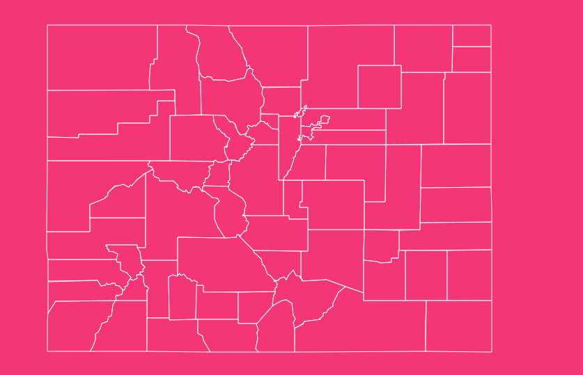
To truly understand a Colorado county map, you must first understand the geography that dictates it. Colorado is often divided into five distinct regions, and county lines frequently follow the natural barriers these regions create.
The Eastern Plains occupy the eastern third of the state. Counties here, such as Yuma, Phillips, and Baca, are typically large, rectangular, and agricultural.
The terrain is relatively flat, allowing for straight, grid-like boundaries.
Moving west, you encounter the Front Range. This is the corridor where the plains meet the mountains. It is the most populous region, home to counties like Adams, Arapahoe, Boulder, and El Paso.
These counties are often smaller in square mileage but incredibly dense in population and infrastructure.
The Rocky Mountains dominate the central portion of the map. Counties here, such as Pitkin, Eagle, and Gunnison, often have irregular boundaries defined by mountain ridges and river valleys.
These lines were drawn to accommodate the rugged terrain and the mining districts of the late 19th century.
Finally, the Western Slope consists of the area west of the Continental Divide. Counties like Mesa and Montrose feature a mix of mountains and desert mesas, with boundaries that often stretch over vast, sparsely populated areas.
Overview of Colorado’s 64 Counties
Colorado is divided into 64 counties. This number has evolved since the designated “original 17” counties were established when the Colorado Territory was formed in 1861.
As the population boomed due to the gold and silver rushes, large territories were subdivided to ensure residents could reach their county seats within a day’s travel, a necessity in the era of horse travel.
Today, these counties range significantly in size and population.
Broomfield is the newest county, consolidated in 2001 to address the unique needs of a rapidly growing suburban area that previously straddled four different counties.
On the other end of the spectrum, Las Animas County covers a massive area in the south, while counties like San Juan have small populations nestled high in the San Juan Mountains.
How to Use the Tool on This Page
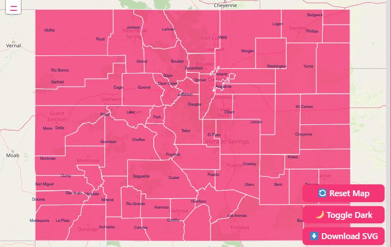
Hover Highlight
When you move your mouse cursor over a specific county on the map, the “Hover Highlight” feature activates. This usually changes the color of the county boundary or outlines it in a bold hue.
Zoom In & Out
Most map viewers offer +/- buttons or scroll-wheel functionality.
- Zoom In: Provides a granular view. This is essential for viewing complex boundaries in mountainous regions where county lines may follow winding river beds or jagged ridge lines.
- Zoom Out: Offers a macro view of the state, perfect for understanding the relative location of a county compared to neighboring states like Utah or Kansas.
Dark Mode Toggle
For users working in low-light environments or those who prefer high-contrast visuals, the Dark Mode toggle inverts the color scheme.
Reset Button
If you have applied multiple filters, zoomed in too far, or selected too many layers, the “Home” or “Reset” button is your escape hatch.
Download Options (Blank Printable SVG & PNG)
Many users need maps for presentations or offline use. Look for a download or print icon.
- PNG: Best for standard documents and quick reference.
- SVG (Scalable Vector Graphics): Best for graphic designers or publishers who need to resize the map without losing image quality.
Exploring Different Data Categories
A robust Colorado county map viewer is not just about lines on a page; it is about the data contained within those lines.
According to the State of Colorado Map Viewer, data is collected from authoritative state and federal sources and organized into several key categories.
Boundaries and Political Layers
This is the most common use case. Users can view the exact legal definitions of county lines. This layer is crucial for real estate agents determining jurisdiction for property taxes and zoning laws.
Education
Map layers often include school district boundaries superimposed over county lines. This helps parents and administrators understand which educational bodies serve specific county residents.
Transportation
This layer highlights the major interstates (I-25, I-70), state highways, and county roads.
In rural counties like Hinsdale or Mineral, understanding the road network is vital, as some areas may be inaccessible during winter months.
Water and Environmental
Colorado is a headwaters state. Map layers often show major river basins, lakes, and reservoirs.
Understanding how water rights and geographical watersheds intersect with county boundaries is a frequent topic of study for environmental scientists.
Safety and Emergency Services
For rural planning, these layers display the jurisdiction of sheriff’s offices, fire protection districts, and emergency response zones, which do not always align perfectly with county limits.
Important Colorado County Insights
When analyzing the data, several counties stand out due to their unique statistics and geographical placement.
Denver County
A consolidated city and county, it acts as the state capital and a primary economic engine.
El Paso County
Home to Colorado Springs, this is traditionally one of the most populous counties in the state.
Larimer County
located in Northern Colorado, it encompasses Fort Collins and vast stretches of Rocky Mountain National Park (FIPS Code 069).
Las Animas County
The largest county by total area, occupying a massive portion of the southern border.
San Juan County
Known for its high elevation and silver mining history, specifically around the county seat of Silverton.
Historical Overview of County Formation
The map of Colorado looked very different in the mid-1800s. The original 17 counties established in 1861 included names that are still familiar today, such as Boulder, Clear Creek, Costilla, and El Paso.
However, the map was fluid. As miners discovered gold in different pockets of the mountains, new governments were needed to enforce claims and laws. This led to the carving out of smaller mountain counties.
For example, Teller County was created from parts of El Paso and Fremont counties largely due to the gold boom in Cripple Creek.
The most recent significant change to the map was the creation of the City and County of Broomfield in 2001.
Previously, the city of Broomfield spread across Adams, Boulder, Jefferson, and Weld counties, creating a bureaucratic nightmare for residents who dealt with four different county seats.
The constitutional amendment to create Broomfield streamlined these services.
The Importance of County Data
Why does accurate county data matter? Beyond simple geography, county-level data is the backbone of state administration.
Public Health
As seen in datasets from the Colorado Department of Public Health and Environment (CDPHE), counties are the primary unit for tracking health statistics and distributing resources.
Voting and Representation
Precinct boundaries are determined at the county level. Knowing your county seat is essential for civic engagement.
Economic Development
Businesses use demographic data sorted by county (population density, median income) to decide where to open new locations.
Emergency Management
During wildfires or floods, evacuation orders and resource deployment are organized by county emergency management offices.
List of Colorado Counties
The following table provides essential details for various Colorado counties, including their Federal Information Processing Standards (FIPS) code and county seat.
| County Name | FIPS Code | County Seat |
| Adams | 001 | Brighton |
| Alamosa | 003 | Alamosa |
| Arapahoe | 005 | Littleton |
| Archuleta | 007 | Pagosa Springs |
| Baca | 009 | Springfield |
| Bent | 011 | Las Animas |
| Boulder | 013 | Boulder |
| Broomfield | 014 | Broomfield |
| Chaffee | 015 | Salida |
| Cheyenne | 017 | Cheyenne Wells |
| Clear Creek | 019 | Georgetown |
| Conejos | 021 | Conejos |
| Costilla | 023 | San Luis |
| Crowley | 025 | Ordway |
| Custer | 027 | Westcliffe |
| Delta | 029 | Delta |
| Denver | 031 | Denver |
| Dolores | 033 | Dove Creek |
| Douglas | 035 | Castle Rock |
| Eagle | 037 | Eagle |
| El Paso | 041 | Colorado Springs |
| Elbert | 039 | Kiowa |
| Fremont | 043 | Cañon City |
| Garfield | 045 | Glenwood Springs |
| Gilpin | 047 | Central City |
| Grand | 049 | Hot Sulphur Springs |
| Gunnison | 051 | Gunnison |
| Hinsdale | 053 | Lake City |
| Huerfano | 055 | Walsenburg |
| Jackson | 057 | Walden |
| Jefferson | 059 | Golden |
| Kiowa | 061 | Eads |
| Kit Carson | 063 | Burlington |
| La Plata | 067 | Durango |
| Lake | 065 | Leadville |
| Larimer | 069 | Fort Collins |
| Las Animas | 071 | Trinidad |
| Lincoln | 073 | Hugo |
| Logan | 075 | Sterling |
| Mesa | 077 | Grand Junction |
| Mineral | 079 | Creede |
| Moffat | 081 | Craig |
| Montezuma | 083 | Cortez |
| Montrose | 085 | Montrose |
| Morgan | 087 | Fort Morgan |
| Otero | 089 | La Junta |
| Ouray | 091 | Ouray |
| Park | 093 | Fairplay |
| Phillips | 095 | Holyoke |
| Pitkin | 097 | Aspen |
| Prowers | 099 | Lamar |
| Pueblo | 101 | Pueblo |
| Rio Blanco | 103 | Meeker |
| Rio Grande | 105 | Del Norte |
| Routt | 107 | Steamboat Springs |
| Saguache | 109 | Saguache |
| San Juan | 111 | Silverton |
| San Miguel | 113 | Telluride |
| Sedgwick | 115 | Julesburg |
| Summit | 117 | Breckenridge |
| Teller | 119 | Cripple Creek |
| Washington | 121 | Akron |
| Weld | 123 | Greeley |
| Yuma | 125 | Wray |
(Note: FIPS codes are abbreviated to the 3-digit county code. The full US FIPS code for Colorado counties begins with the state code 08, e.g., Adams County is 08001.)
Frequently Asked Questions
How many counties are in Colorado?
There are 64 counties in the state of Colorado.
What is the newest county in Colorado?
Broomfield is the newest county, established in 2001 as a consolidated city and county.
Which Colorado county has FIPS code 031?
FIPS code 031 belongs to Denver County.
Where can I find the county seat for Jefferson County?
The county seat for Jefferson County is Golden.
Are Colorado county maps updated in real-time?
According to the State of Colorado Map Viewer, data is organized by categories and updated in real-time with the source, meaning when the source agency updates their data, the map reflects it.
Can I download vector images of Colorado counties?
Yes, many map tools allow you to download SVG (Scalable Vector Graphics) files, which are perfect for printing and editing.
Which county is home to Colorado Springs?
Colorado Springs is the county seat of El Paso County (FIPS 041).
Do county lines in Colorado follow mountain ranges?
Yes, in the central and western parts of the state, many county boundaries are defined by the Continental Divide or specific mountain ridges.
What is the FIPS code for Larimer County?
The FIPS code for Larimer County is 069 (or 08069 including the state code).
Is the map data considered a legal land survey?
No. All digital map viewers come with a disclaimer that they are for informational purposes only and do not replace an official land survey.
Conclusion
Whether you are a data analyst poring over FIPS codes or a traveler planning a road trip through the Rockies, having access to an accurate Colorado county map is indispensable.
These 64 counties represent the diverse history, geography, and governance of the Centennial State.
By utilizing the interactive tools and data tables provided in this guide, you can navigate Colorado’s boundaries with confidence.
[Download Free Map].