California is massive. It’s not just a state; it’s an economic powerhouse and a geographical marvel that stretches nearly 900 miles from the Mexican border to Oregon.
But to truly understand the Golden State, you have to look beyond the beaches of Malibu or the tech hubs of Silicon Valley. You need to look at how it’s organized.
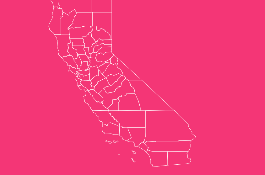
Interactive Map of California Counties
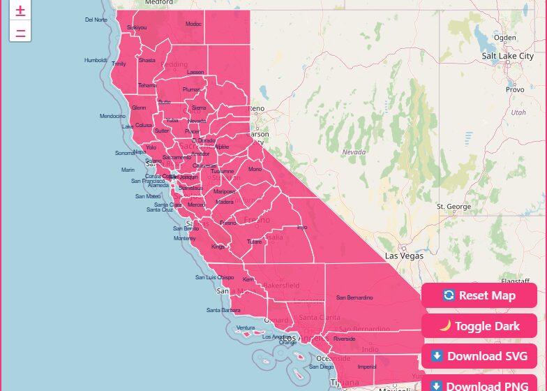
Exploring California’s geography is easier when you can visualize it. Our interactive map tool allows you to dive deep into the specific data of all 58 counties.
How to Use the Tool on This Page
Hover Highlight
Simply move your mouse over any area of the map. The county will highlight, displaying its name and key quick-stats immediately.
Zoom In & Out
Use the scroll wheel on your mouse or the +/- buttons in the corner of the map to get a closer look at dense areas like the Bay Area or Southern California.
Dark Mode Toggle
Prefer a different aesthetic? Switch between light and dark modes to view the map in a style that suits your screen environment.
Reset Button
If you’ve zoomed in too far or lost your place, hit the reset button to return to the default statewide view.
Download Options
Need a map for a presentation or project? You can download a blank printable SVG or PNG version of the map directly from the tool.
Historical Overview of County Formation
The map of California hasn’t always looked the way it does today. When California was granted statehood on September 9, 1850, it was originally divided into just 27 counties.
In those early days, the boundaries were vast and often undefined.
As the Gold Rush brought a massive influx of people to the northern and central parts of the state, the need for more localized governance became clear.
Between 1850 and 1860, sixteen additional counties were carved out of existing territories to manage the booming population.
The evolution continued through the late 19th century. From 1861 to 1893, another fourteen counties were formed.
The final piece of the puzzle fell into place in 1907 with the creation of Imperial County in the southeast corner of the state, bringing the total to the current 58.
Geographical Overview of California Regions
To make sense of 58 counties, it helps to group them by region. While there are many ways to slice the state, the California Association of Local Behavioral Health Boards and Commissions (CALBHBC) categorizes them into five distinct regions.
Superior Region (16 Counties)
This is Northern California in its truest form. It includes the rugged coastlines, the redwood forests, and the quieter, rural communities.
- Counties: Butte, Colusa, Del Norte, Glenn, Humboldt, Lake, Lassen, Mendocino, Modoc, Nevada, Plumas, Shasta, Sierra, Siskiyou, Tehama, Trinity.
Central Region (20 Counties)
The Central region is the agricultural heartland of the state, combined with the Sierra Nevada mountains. It produces a significant portion of the nation’s food.
- Counties: Alpine, Amador, Calaveras, El Dorado, Fresno, Inyo, Kings, Madera, Mariposa, Merced, Mono, Placer, Sacramento, San Joaquin, Stanislaus, Sutter, Tulare, Tuolumne, Yolo, Yuba.
Bay Area (13 Jurisdictions)
Home to tech giants and historic cities, this region surrounds the San Francisco Bay. It is dense, wealthy, and culturally diverse.
- Counties: Alameda, Contra Costa, Marin, Monterey, Napa, San Benito, San Francisco, San Mateo, Santa Clara, Santa Cruz, Solano, Sonoma.
Southern Region (10 Jurisdictions)
This area is known for its warm weather, deserts, and extensive coastline. It includes the Inland Empire and the border counties.
- Counties: Imperial, Kern, Orange, Riverside, San Bernardino, San Diego, San Luis Obispo, Santa Barbara, Ventura.
Los Angeles
Due to its sheer size and population density, Los Angeles often stands alone in regional breakdowns.
- County: Los Angeles.
Important California County Insights
When analyzing the map, two counties often stand out for their extreme statistics: San Bernardino and Los Angeles.
San Bernardino: The Largest County
San Bernardino County is geographically immense. It covers over 20,000 square miles, making it the largest county in the contiguous United States.
To put that in perspective, San Bernardino County is larger than nine separate U.S. states, including New Jersey, Massachusetts, and Maryland.
It encompasses vast stretches of the Mojave Desert and the San Bernardino Mountains.
Los Angeles: The Most Populous
On the other end of the spectrum is population density. Los Angeles County is the most populous county in the entire United States, with nearly 10 million residents.
If LA County were a state, it would be the 11th most populous state in the union, ranking just behind Michigan.
This density presents unique challenges for local governance, requiring a massive infrastructure for public services.
The Importance of County Data
County governments manage a wide array of critical functions:
Public Health
Managing hospitals, mental health services, and pandemic responses.
Law Enforcement
The Sheriff’s Department operates at the county level, managing jails and patrolling unincorporated areas.
Social Services
Distributing welfare, foster care, and adoption services.
Elections
Running polling places and counting votes during elections.
Land Use
Zoning and planning for areas outside of city limits.
Understanding county lines helps businesses decide where to operate, helps voters understand who represents them, and helps researchers track demographic trends across the state.
List of California Counties
Below is a complete table of all 58 counties, including their Federal Information Processing Standards (FIPS) code, county seat (administrative center), and the year they were established.
| County Name | FIPS Code | County Seat | Established Year |
| Alameda | 001 | Oakland | 1853 |
| Alpine | 003 | Markleeville | 1864 |
| Amador | 005 | Jackson | 1854 |
| Butte | 007 | Oroville | 1850 |
| Calaveras | 009 | San Andreas | 1850 |
| Colusa | 011 | Colusa | 1850 |
| Contra Costa | 013 | Martinez | 1850 |
| Del Norte | 015 | Crescent City | 1857 |
| El Dorado | 017 | Placerville | 1850 |
| Fresno | 019 | Fresno | 1856 |
| Glenn | 021 | Willows | 1891 |
| Humboldt | 023 | Eureka | 1853 |
| Imperial | 025 | El Centro | 1907 |
| Inyo | 027 | Independence | 1866 |
| Kern | 029 | Bakersfield | 1866 |
| Kings | 031 | Hanford | 1893 |
| Lake | 033 | Lakeport | 1861 |
| Lassen | 035 | Susanville | 1864 |
| Los Angeles | 037 | Los Angeles | 1850 |
| Madera | 039 | Madera | 1893 |
| Marin | 041 | San Rafael | 1850 |
| Mariposa | 043 | Mariposa | 1850 |
| Mendocino | 045 | Ukiah | 1850 |
| Merced | 047 | Merced | 1855 |
| Modoc | 049 | Alturas | 1874 |
| Mono | 051 | Bridgeport | 1861 |
| Monterey | 053 | Salinas | 1850 |
| Napa | 055 | Napa | 1850 |
| Nevada | 057 | Nevada City | 1851 |
| Orange | 059 | Santa Ana | 1889 |
| Placer | 061 | Auburn | 1851 |
| Plumas | 063 | Quincy | 1854 |
| Riverside | 065 | Riverside | 1893 |
| Sacramento | 067 | Sacramento | 1850 |
| San Benito | 069 | Hollister | 1874 |
| San Bernardino | 071 | San Bernardino | 1853 |
| San Diego | 073 | San Diego | 1850 |
| San Francisco | 075 | San Francisco | 1850 |
| San Joaquin | 077 | Stockton | 1850 |
| San Luis Obispo | 079 | San Luis Obispo | 1850 |
| San Mateo | 081 | Redwood City | 1856 |
| Santa Barbara | 083 | Santa Barbara | 1850 |
| Santa Clara | 085 | San Jose | 1850 |
| Santa Cruz | 087 | Santa Cruz | 1850 |
| Shasta | 089 | Redding | 1850 |
| Sierra | 091 | Downieville | 1852 |
| Siskiyou | 093 | Yreka | 1852 |
| Solano | 095 | Fairfield | 1850 |
| Sonoma | 097 | Santa Rosa | 1850 |
| Stanislaus | 099 | Modesto | 1854 |
| Sutter | 101 | Yuba City | 1850 |
| Tehama | 103 | Red Bluff | 1856 |
| Trinity | 105 | Weaverville | 1850 |
| Tulare | 107 | Visalia | 1852 |
| Tuolumne | 109 | Sonora | 1850 |
| Ventura | 111 | Ventura | 1872 |
| Yolo | 113 | Woodland | 1850 |
| Yuba | 115 | Marysville | 1850 |
Why this Map Matters for You
Whether you are looking for the sprawling deserts of San Bernardino or the tech-heavy corridors of Santa Clara, each county contributes a unique piece to the California puzzle.
[Download Your Free California County Map].
Frequently Asked Questions
How many counties are in California?
There are 58 counties in California. This number has remained consistent since 1907, when Imperial County became the final county to be established.
What is the largest county in California by area?
San Bernardino County is the largest by area, covering over 20,000 square miles. It is also the largest county in the entire contiguous United States.
Which California county has the highest population?
Los Angeles County is the most populous, with nearly 10 million residents. It has a larger population than 40 individual U.S. states.
What was the first county created in California?
There isn’t a single “first” county. When California became a state in 1850, 27 original counties were created simultaneously. These included counties like San Diego, Los Angeles, San Francisco, and Sacramento.
Which California county is the smallest?
San Francisco County is the smallest by land area. It is a consolidated city-county, meaning the city and county governments are merged into one jurisdiction.
What is a “General Law” vs. “Charter” county?
California counties are either General Law or Charter counties.
General Law counties follow state laws for their structure, while Charter counties (like Los Angeles and San Francisco) have adopted a local charter that gives them more flexibility in governance and election processes.
Why are Northern California counties smaller than Southern ones?
Many Northern counties were formed during the Gold Rush (1848–1855). As populations exploded in mining areas, smaller counties were created to provide closer local governance.
The Southern counties, largely desert and agricultural land at the time, remained larger geographically.
Can I download a map of California counties for free?
Yes, this page offers download options for blank printable maps in both SVG and PNG formats, perfect for educational or business use.